Krauss et al. 2020
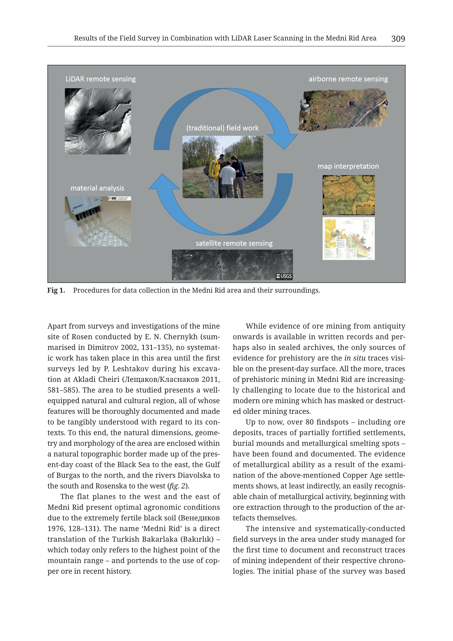
mixed (conceptual workflow diagram + embedded photograph thumbnails; not a geologic map)
Fig 1.; printed page header 309; filename Tub_p311; chapter running head “Results of the Field Survey in Combination with LiDAR Laser Scanning in the Medni Rid Area”
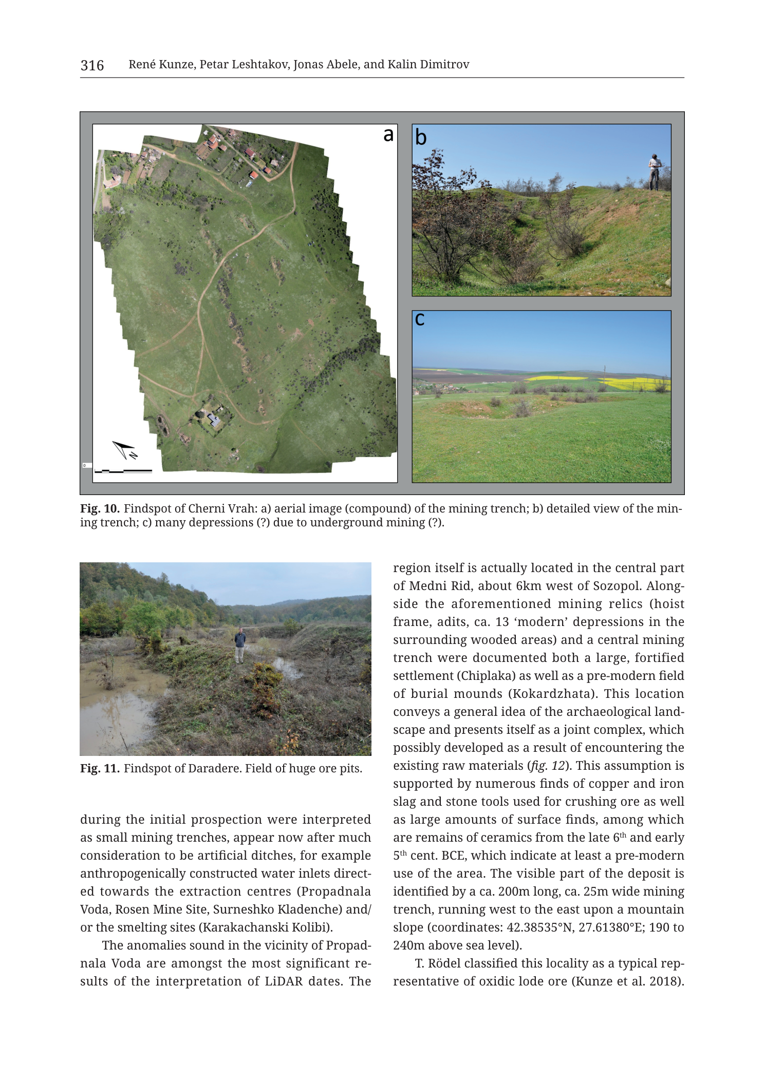
mixed (aerial orthophoto mosaic + ground photographs of mining landscape)
Fig. 10 (panels a–c) and also Fig. 11 on same page; printed page header 316; filename Tub_p318
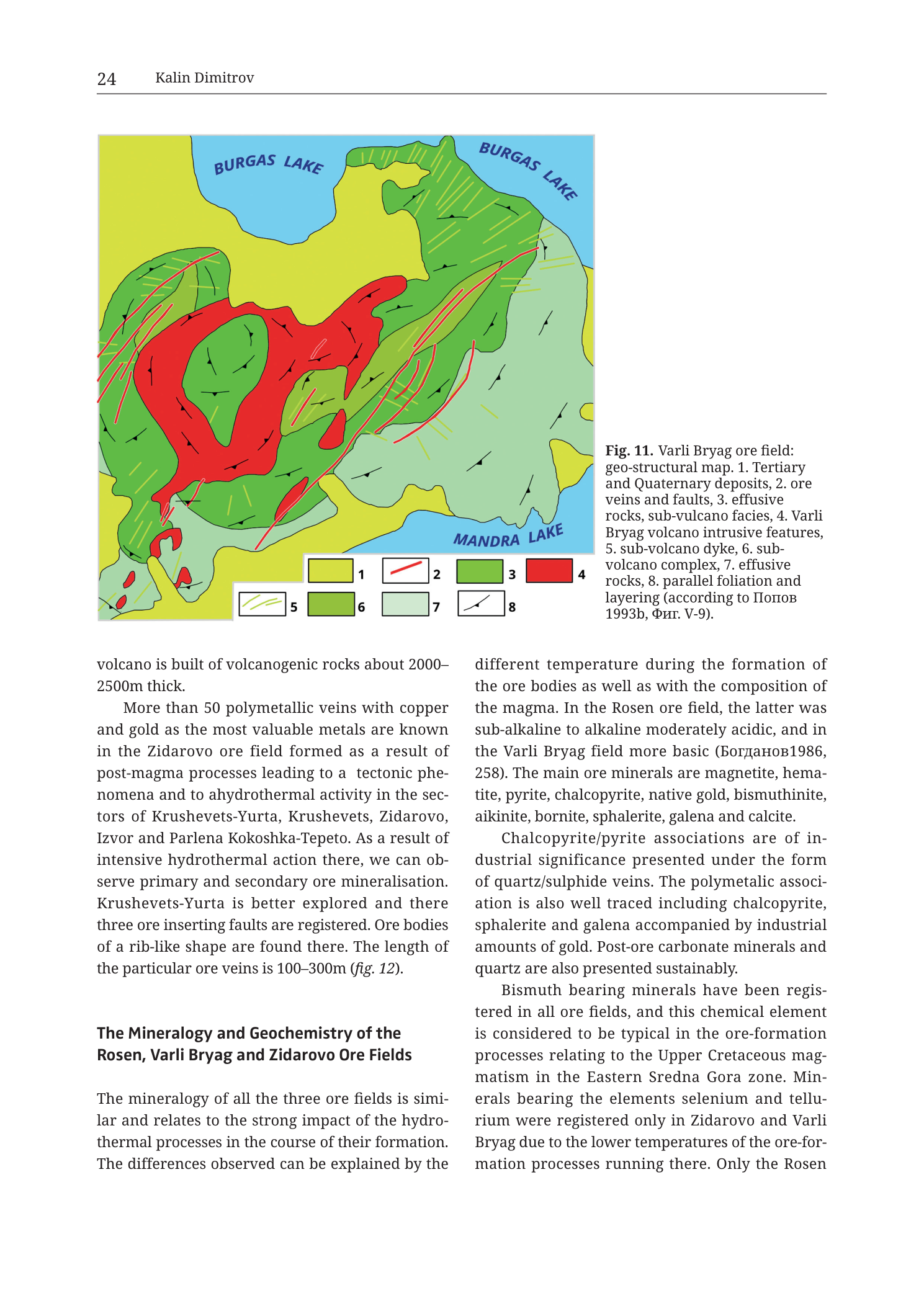
map
Fig. 11; printed page header 24; filename Tub_p026
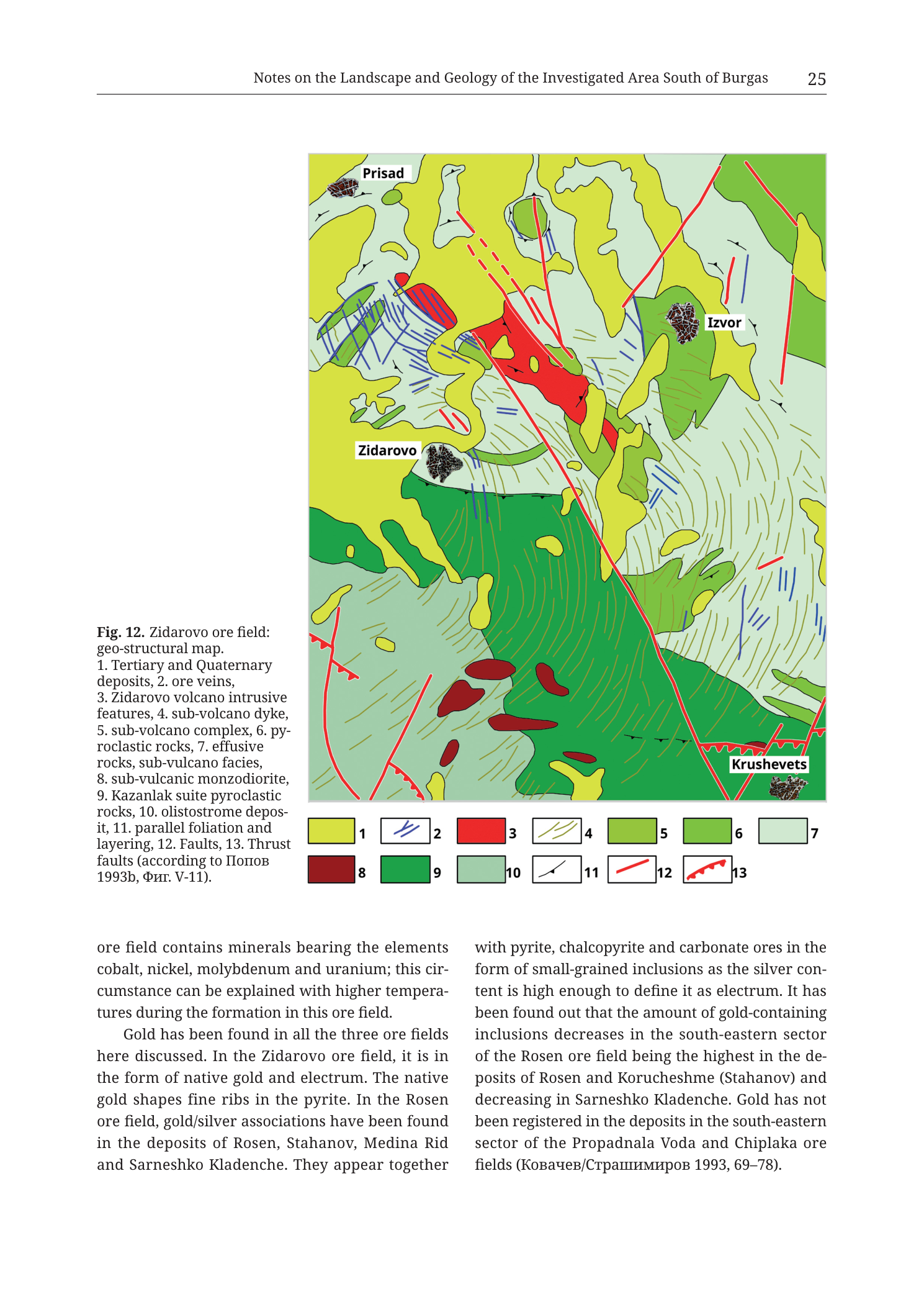
map
Fig. 12; printed page header 25; filename Tub_p027
map
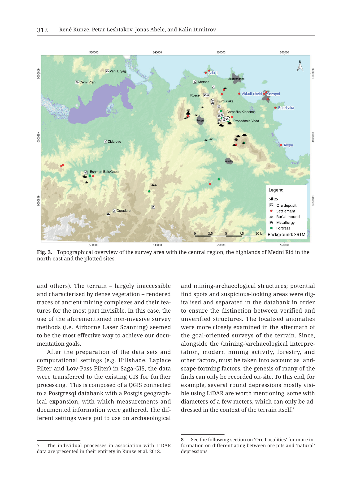
Fig. 3; printed page header 312; filename Tub_p314; authors running head “René Kunze, Petar Leshtakov, Jonas Abele, and Kalin Dimitrov”
map+cross-section
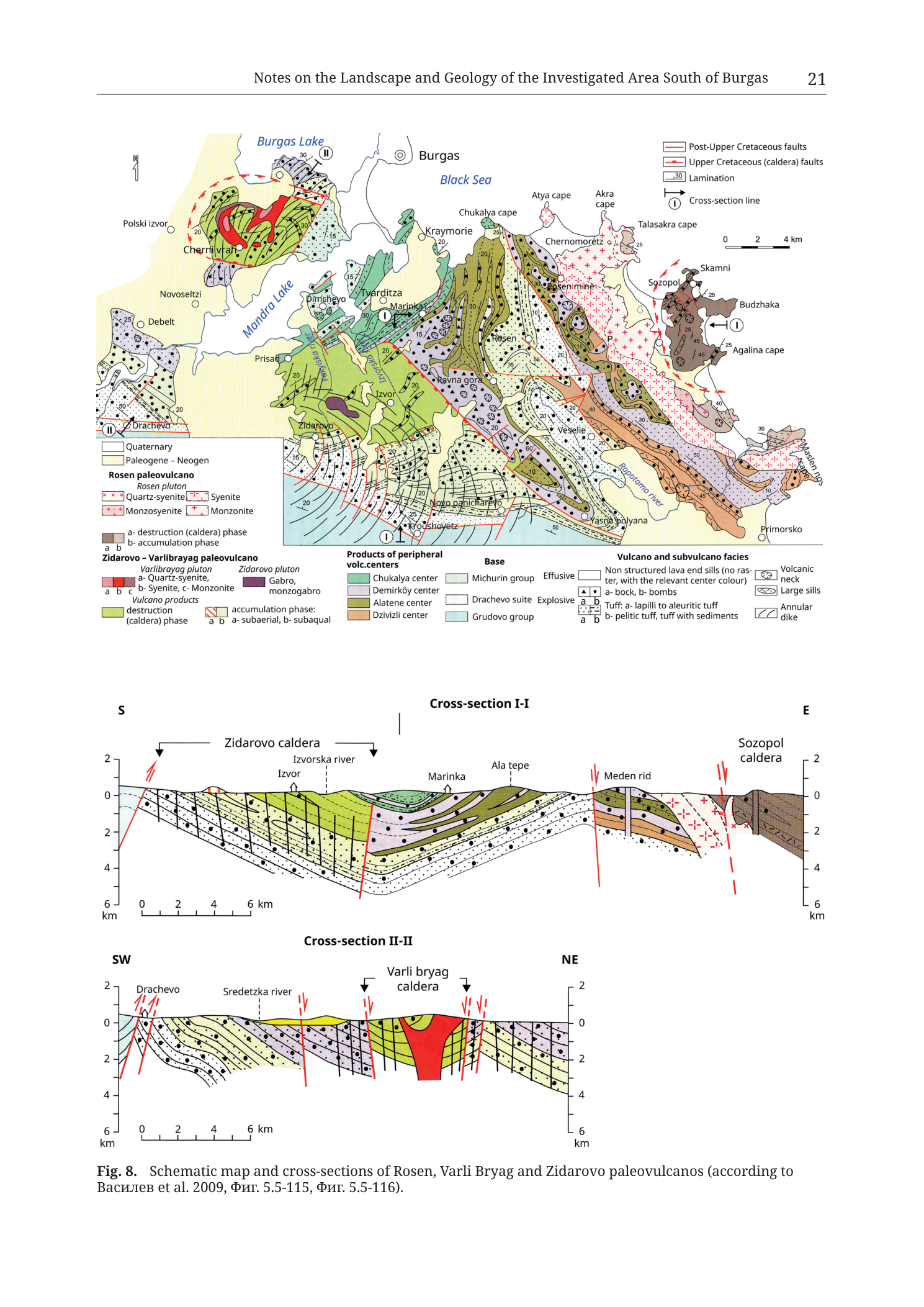
Fig. 8; printed page header 21; filename Tub_p023
cross-section
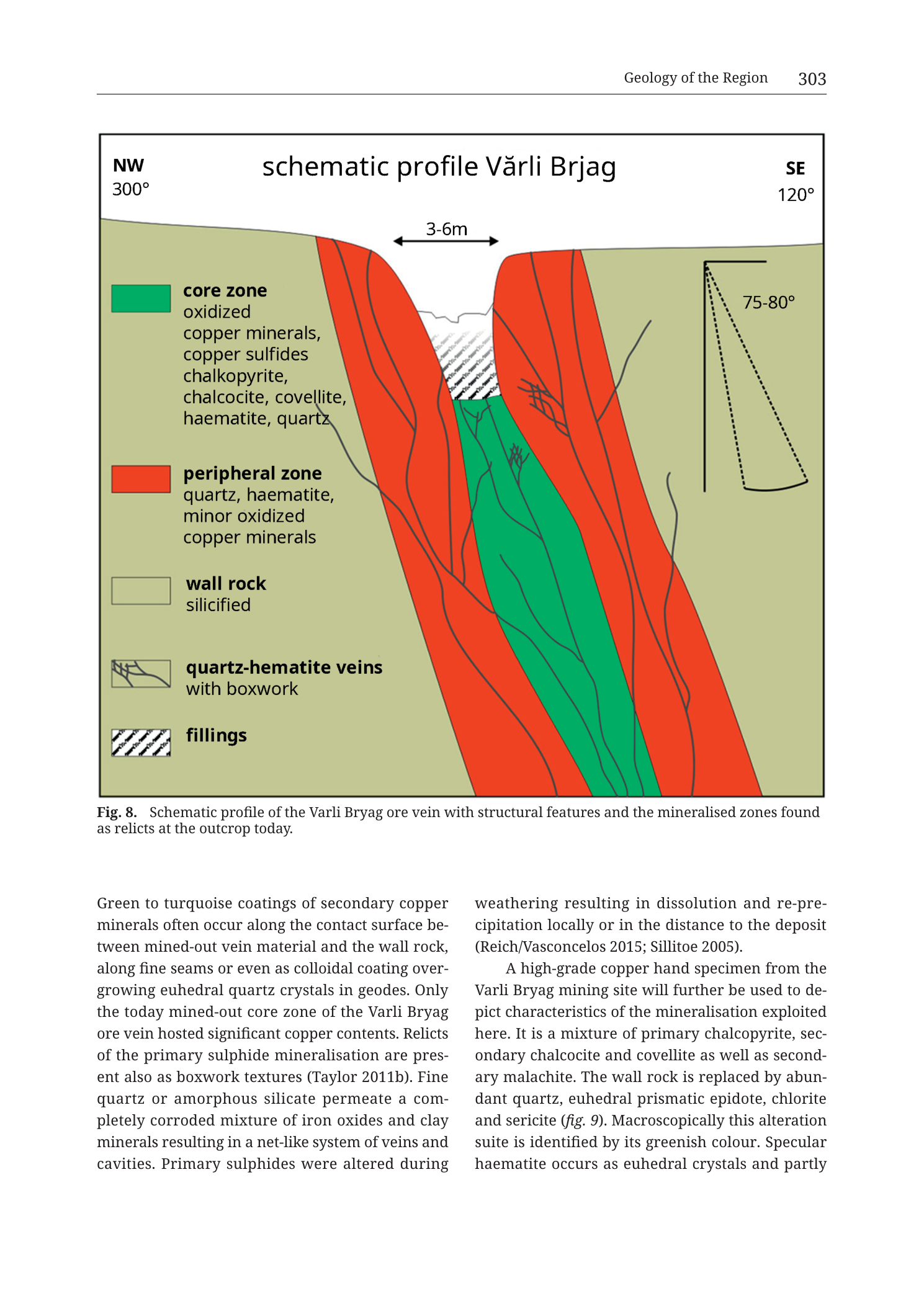
Fig. 8; printed page header 303; filename Tub_p305; chapter running head “Geology of the Region”
map
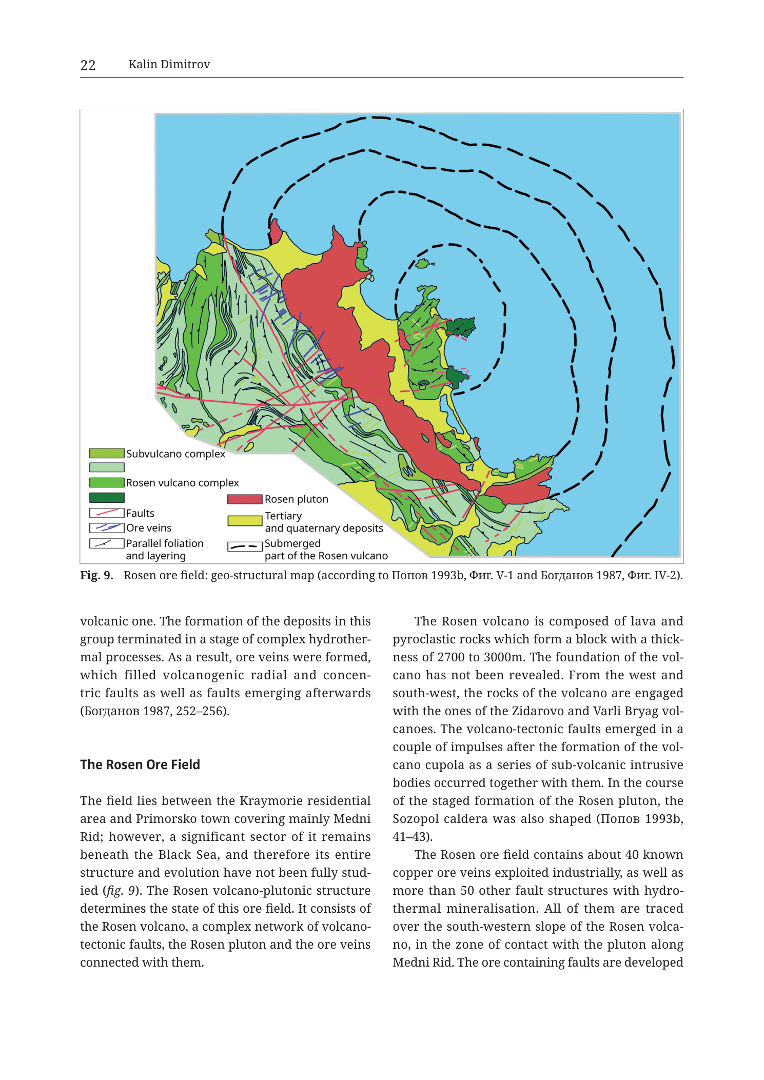
Fig. 9; printed page header 22; filename Tub_p024
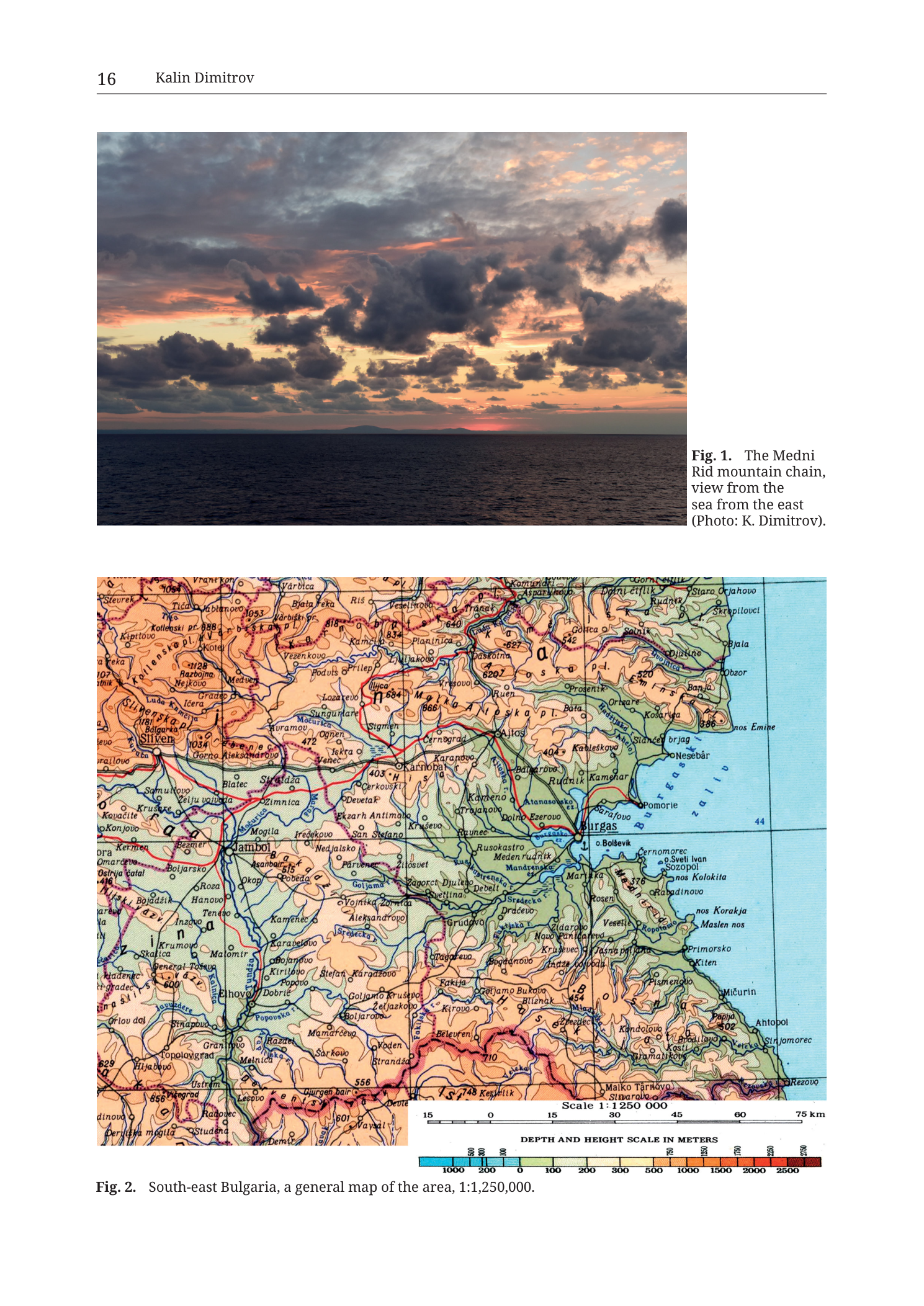
mixed
p. 16 / Fig. 1 and Fig. 2 (page header "16"; filename Tub_p018 is source-PDF page offset)
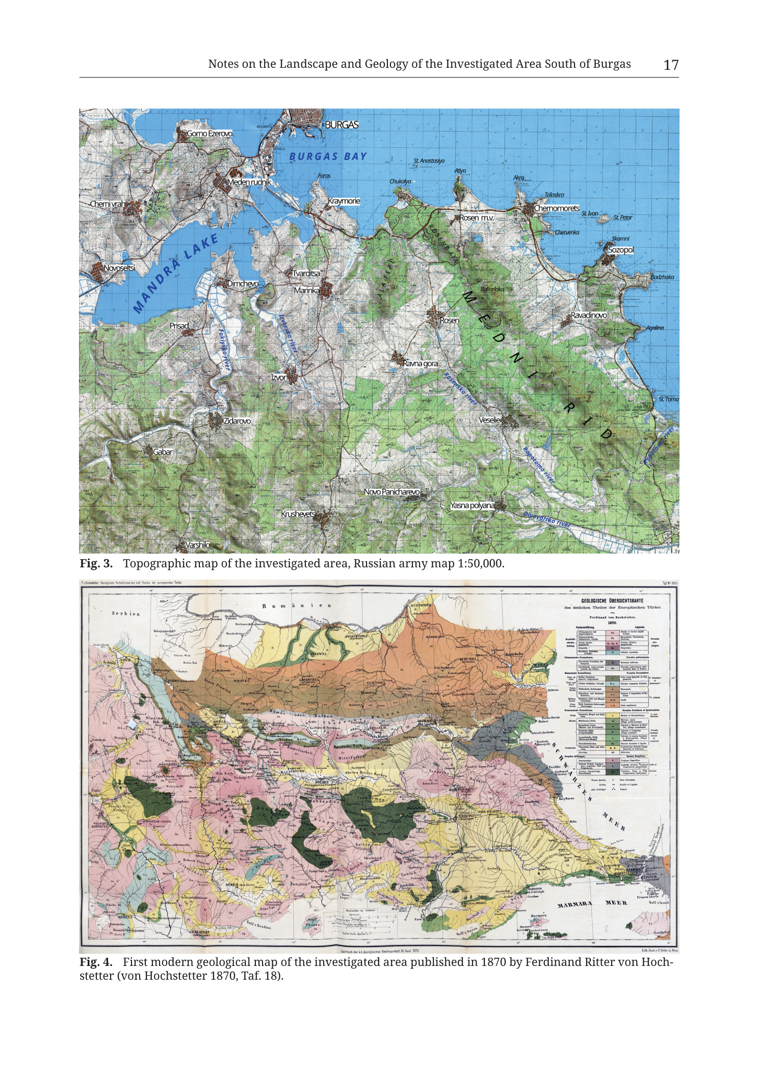
mixed
p. 17 / Fig. 3 and Fig. 4 (page header "17"; filename Tub_p019 is source-PDF page offset; printed Hochstetter date in caption is 1870, not 1879)
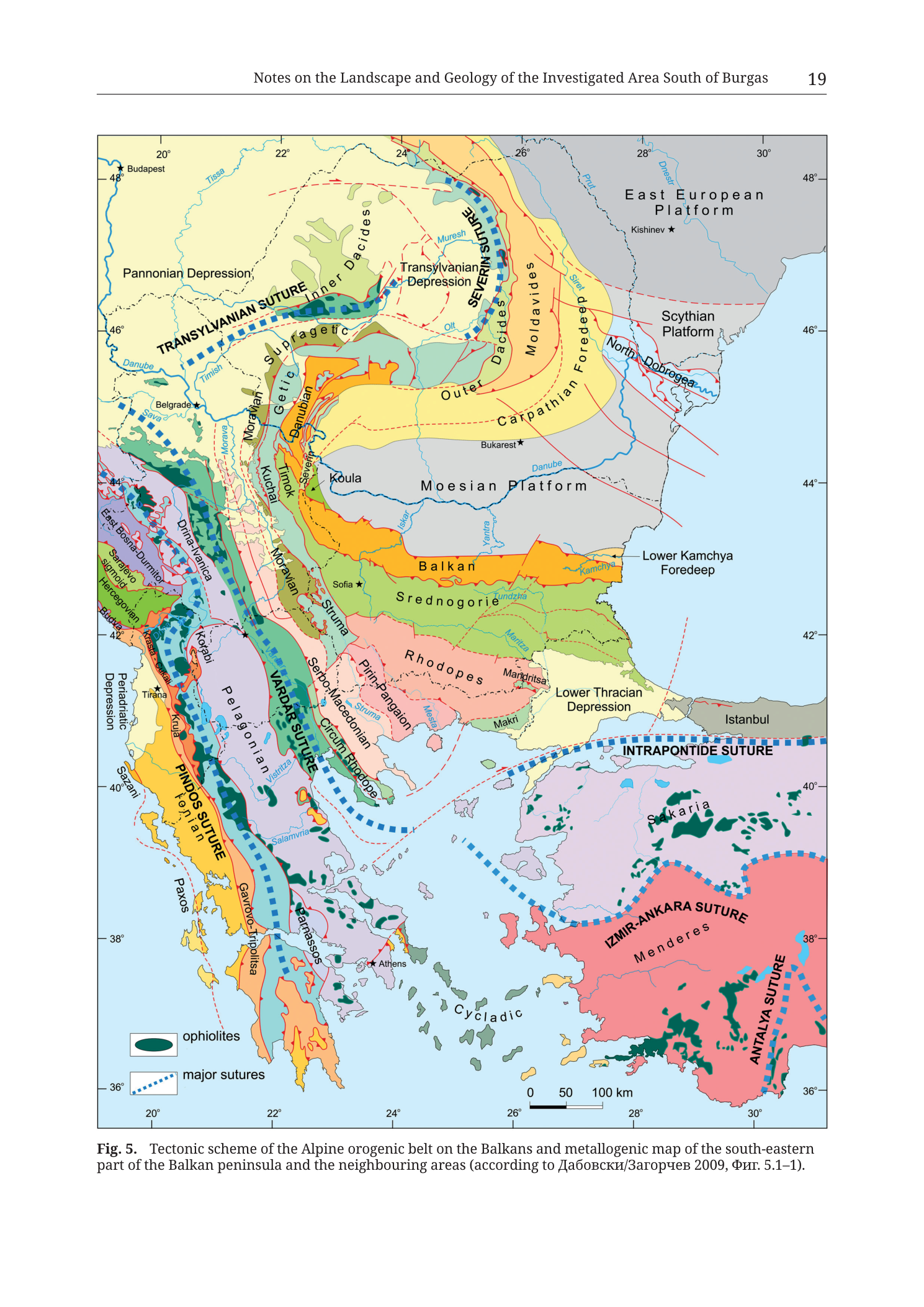
map
p. 19 / Fig. 5 (page header "19"; filename Tub_p021 is source-PDF page offset)
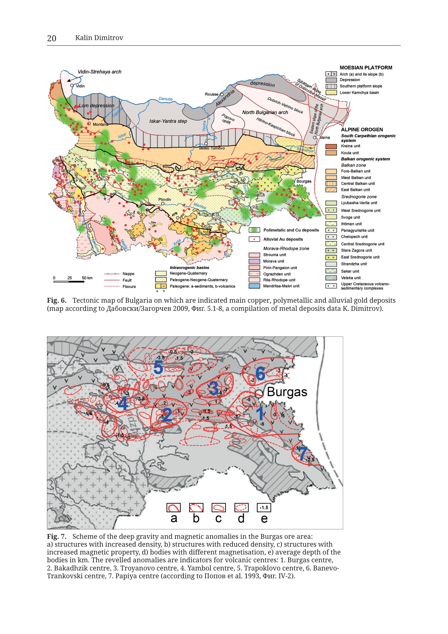
mixed
p. 20 / Fig. 6 and Fig. 7 (page header "20"; filename Tub_p022 is source-PDF page offset)
map
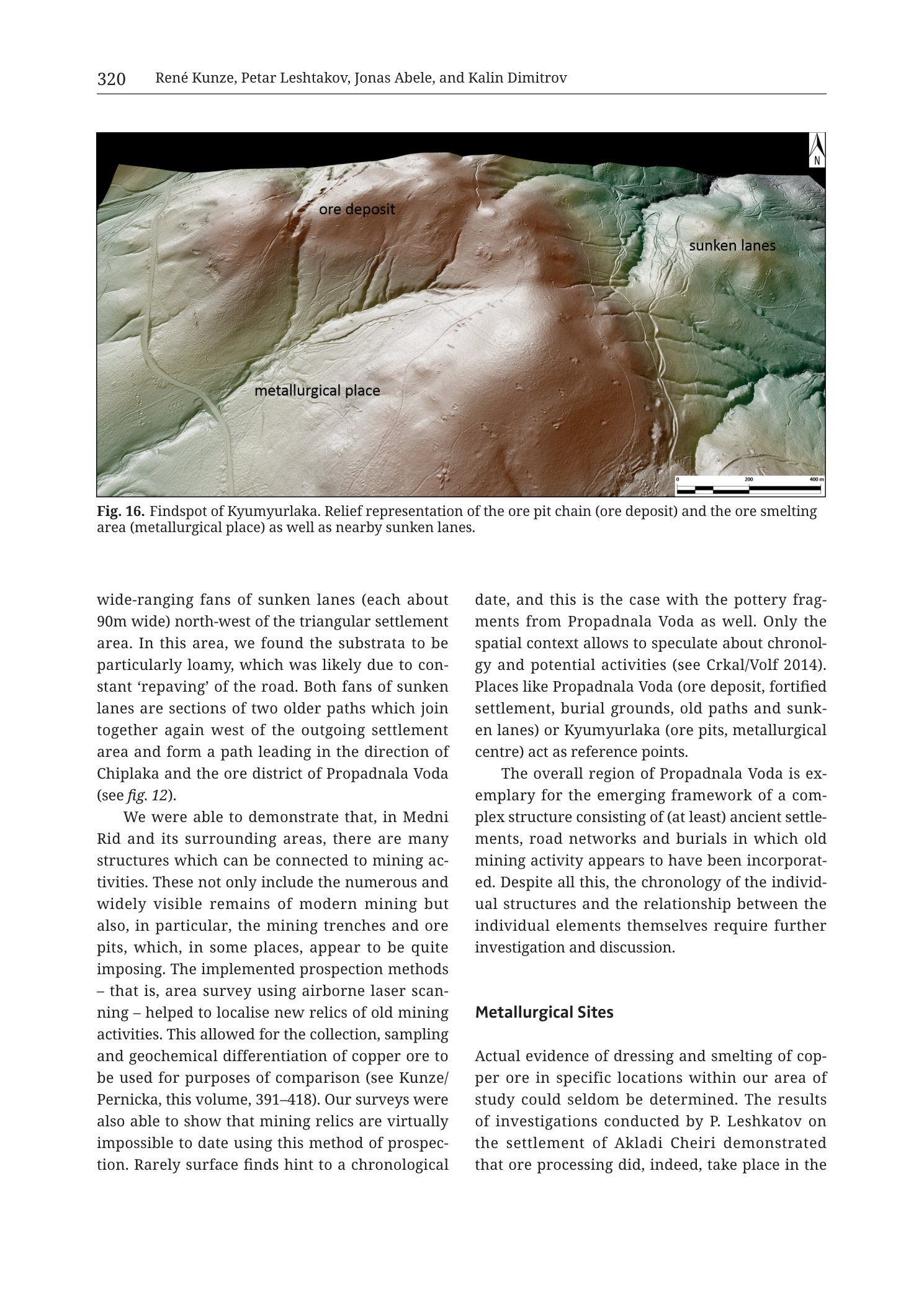
p. 320 / Fig. 16 (filename Tub_p322)
map
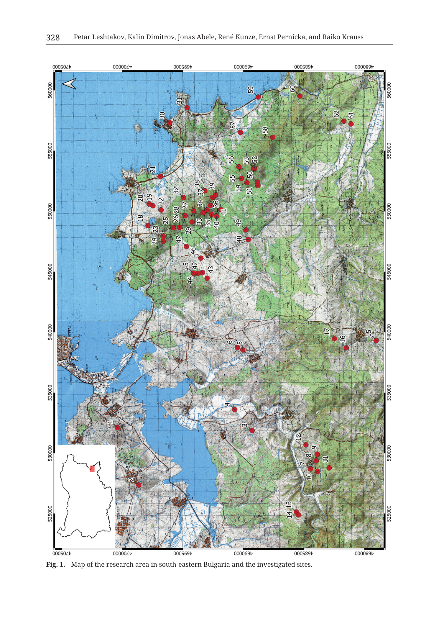
p. 328 / Fig. 1 (filename Tub_p330)
mixed
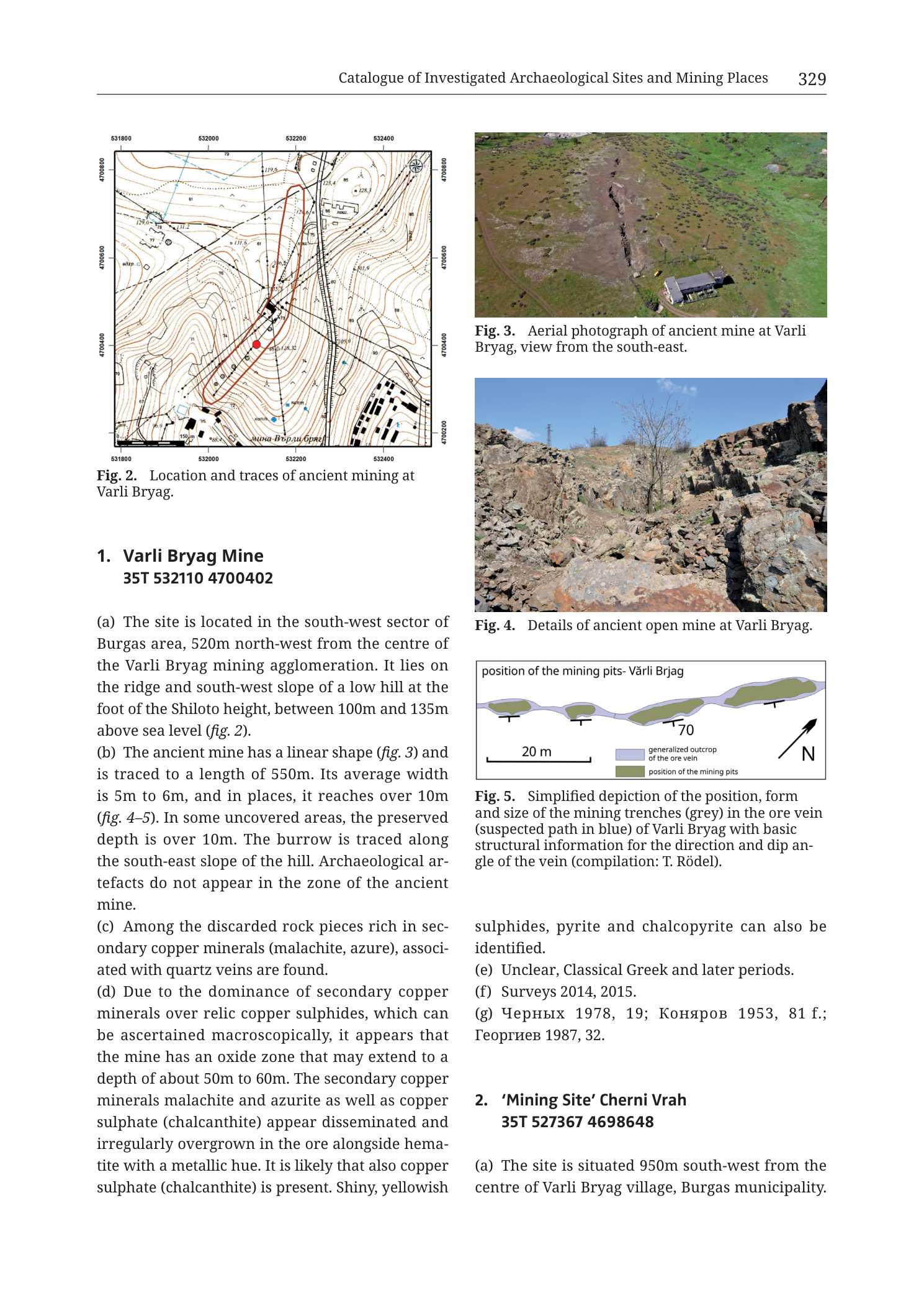
p. 329 (printed header); catalogue entries 1. Varli Bryag Mine and start of 2. 'Mining Site' Cherni Vrah; Figs. 2–5
mixed
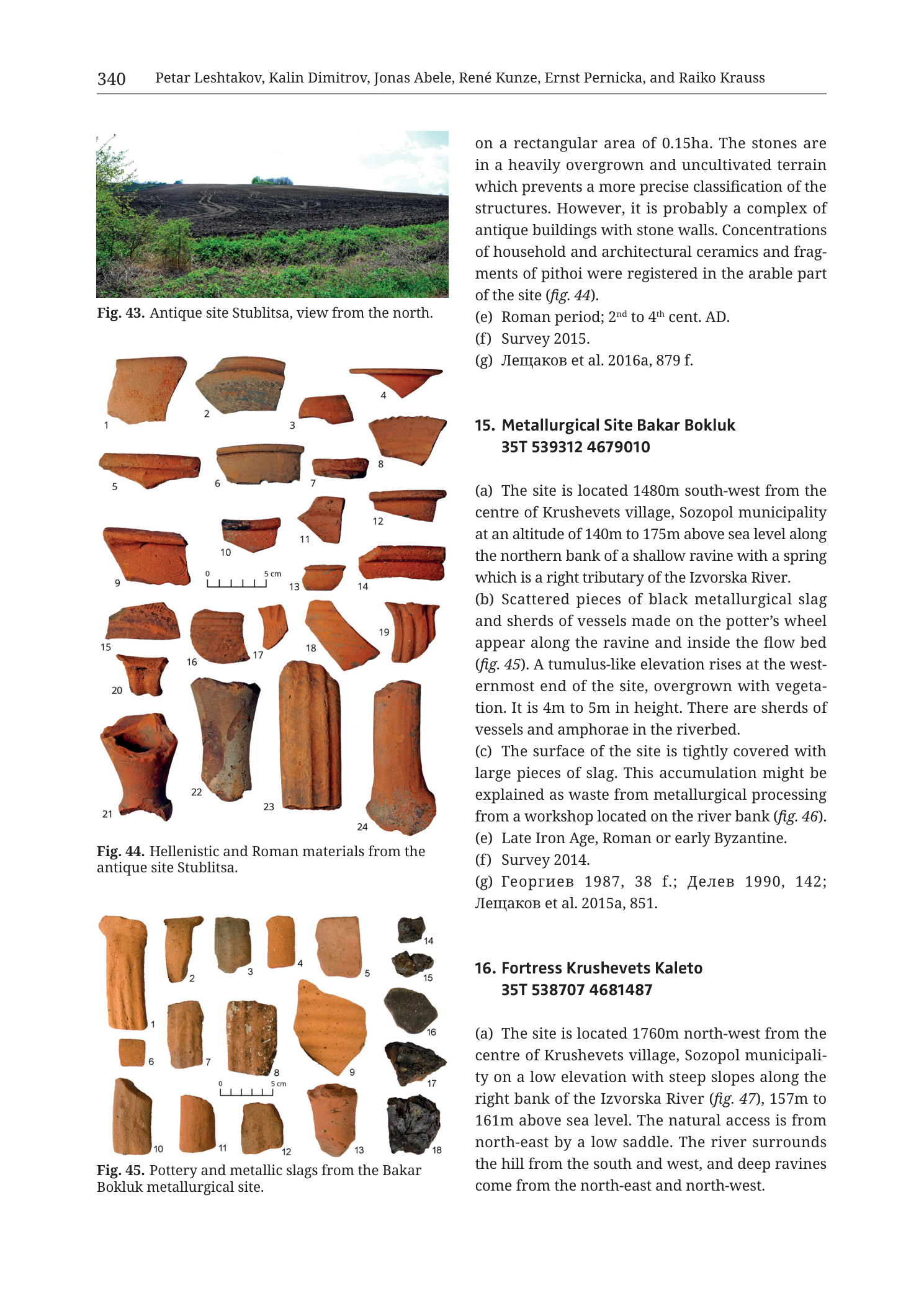
p. 340 (printed header); catalogue entries continuing prior site (Stublitsa), 15. Metallurgical Site Bakar Bokluk, and start of 16. Fortress Krushevets Kaleto; Figs. 43–45
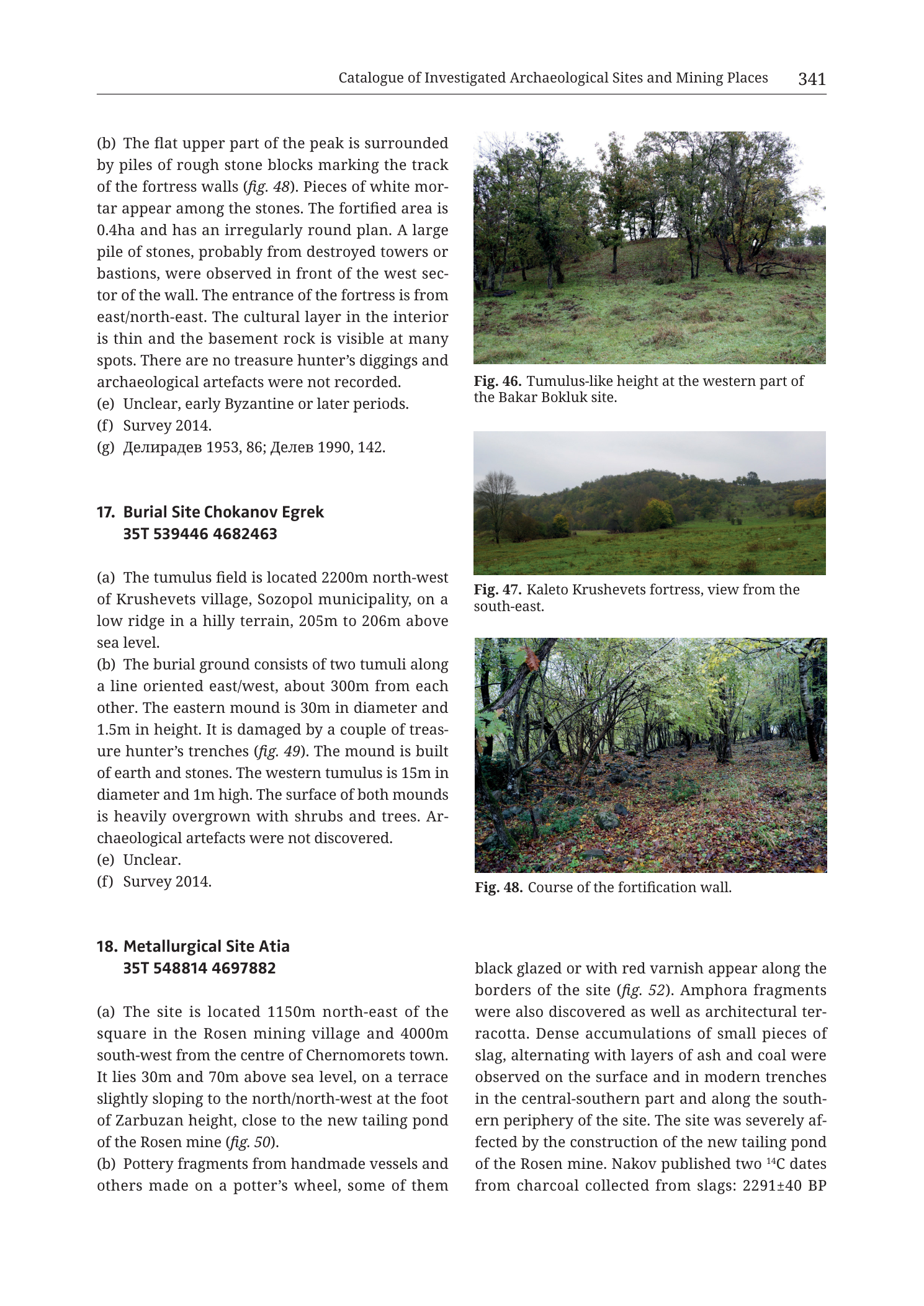
mixed
p. 341 (printed header); continuation of 16. Fortress Krushevets Kaleto; full 17. Burial Site Chokanov Egrek; start/majority of 18. Metallurgical Site Atia; Figs. 46–48
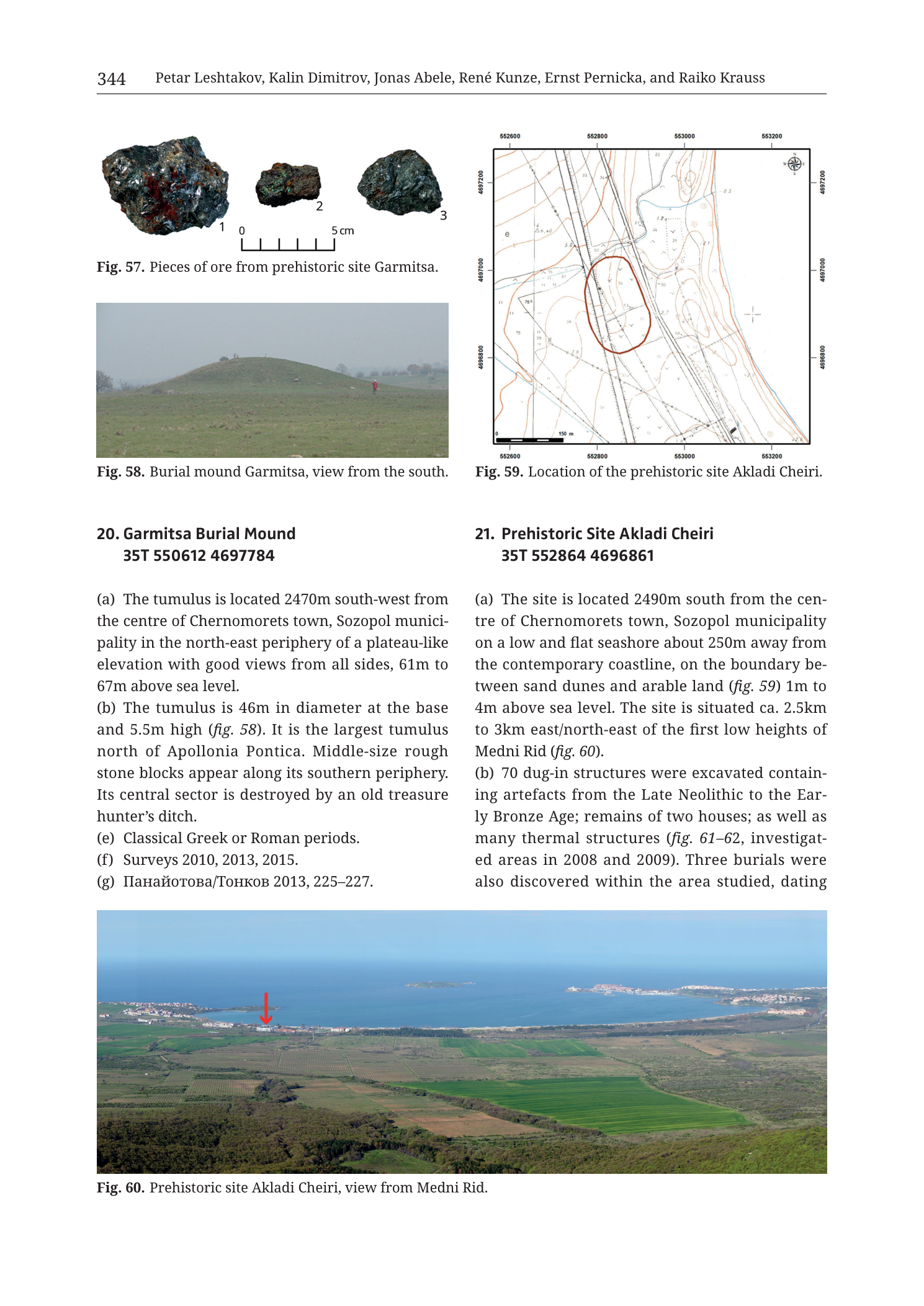
mixed
p. 344 (printed header); entries 20. Garmitsa Burial Mound and 21. Prehistoric Site Akladi Cheiri; Figs. 57–60
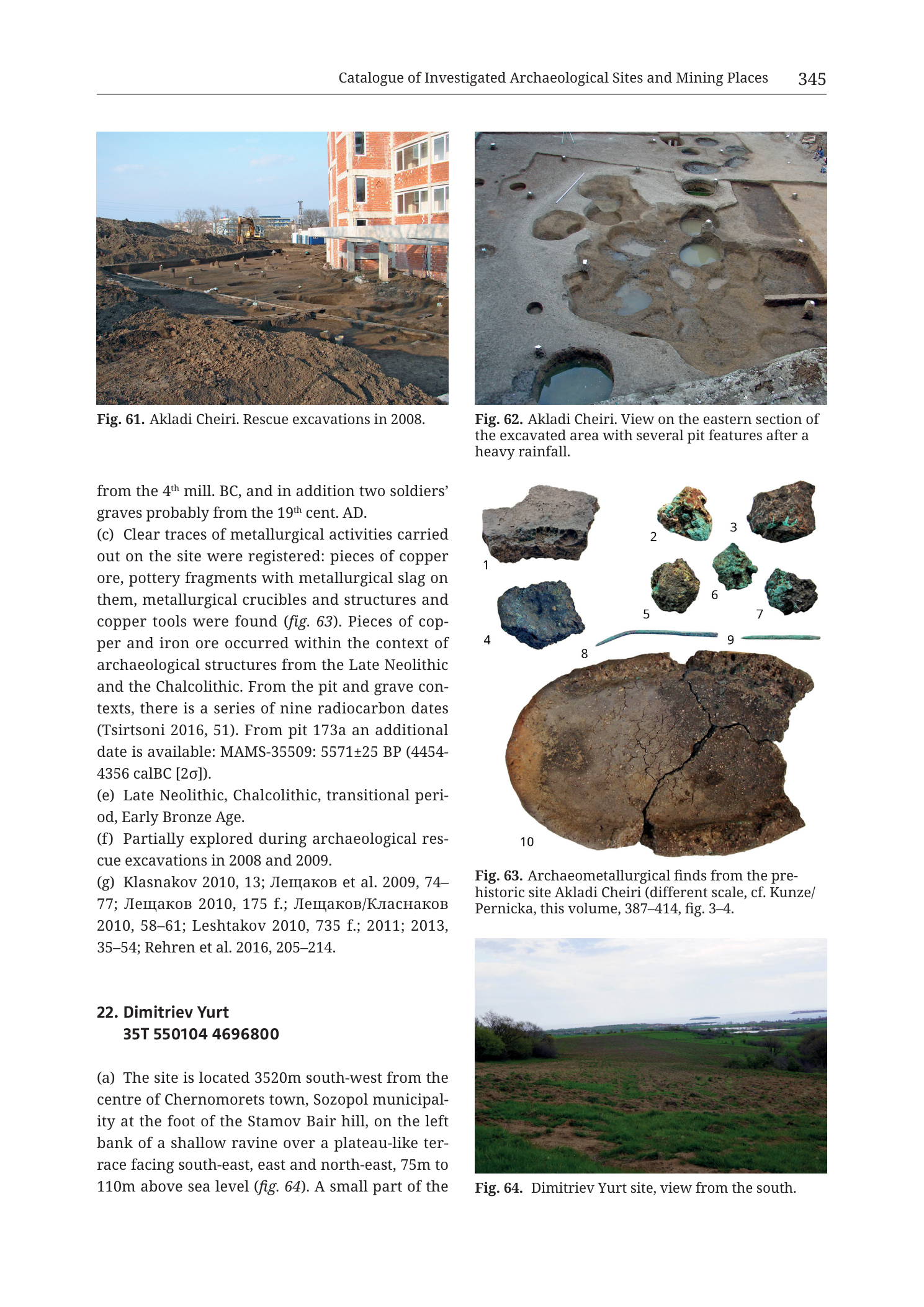
mixed
p. 345 (printed header); continuation and close of 21. Prehistoric Site Akladi Cheiri; start of 22. Dimitriev Yurt; Figs. 61–64
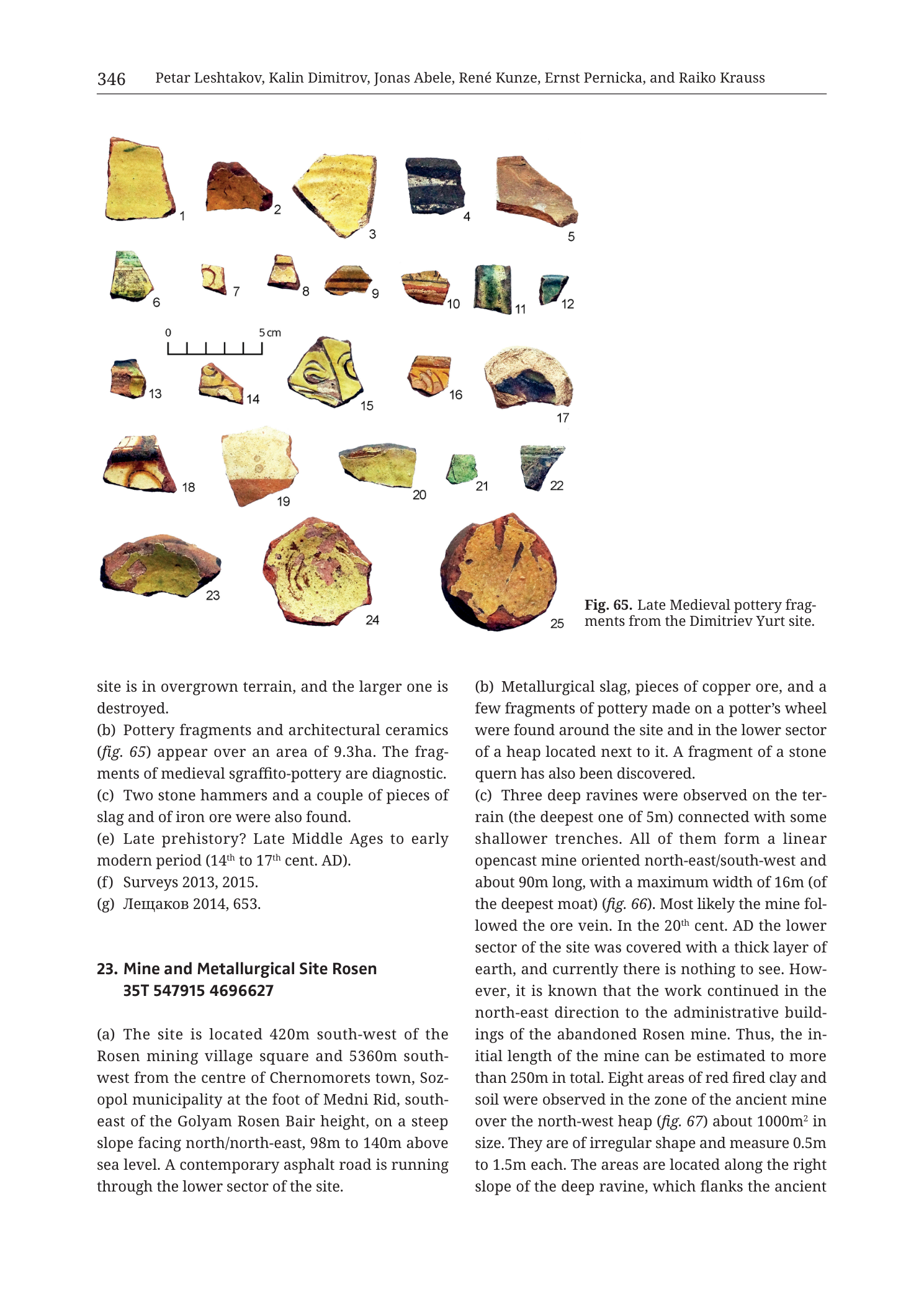
mixed
p. 346 (printed header); close of 22. Dimitriev Yurt; start/majority of 23. Mine and Metallurgical Site Rosen; Fig. 65
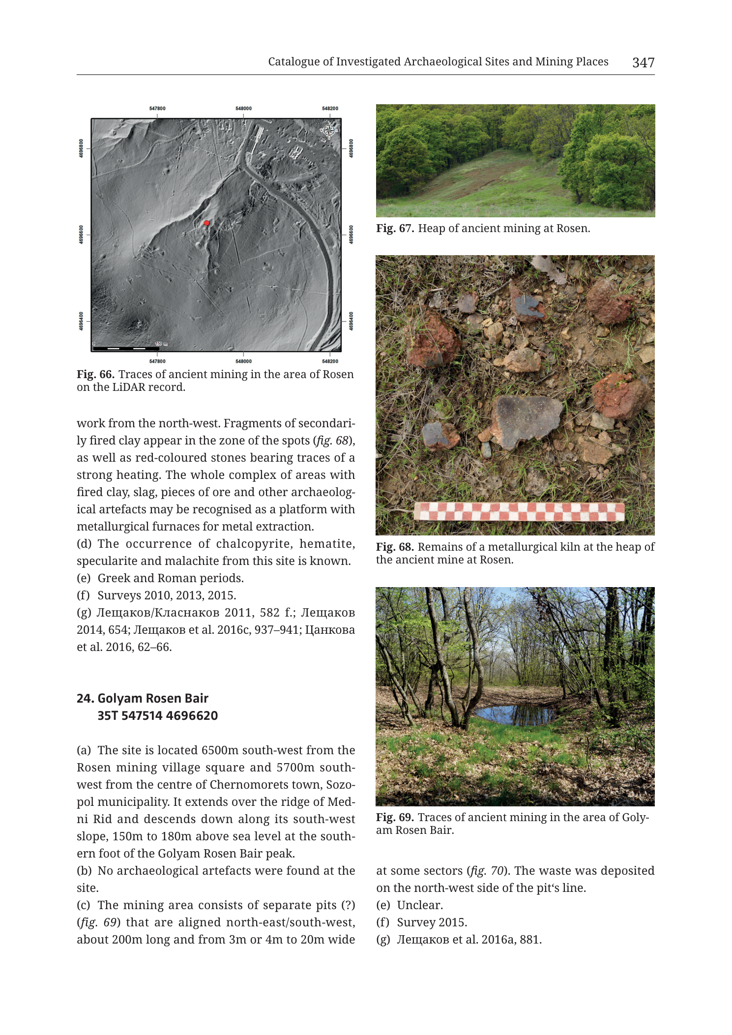
mixed
p. 347 (printed header); close of 23. Mine and Metallurgical Site Rosen; full 24. Golyam Rosen Bair; Figs. 66–69
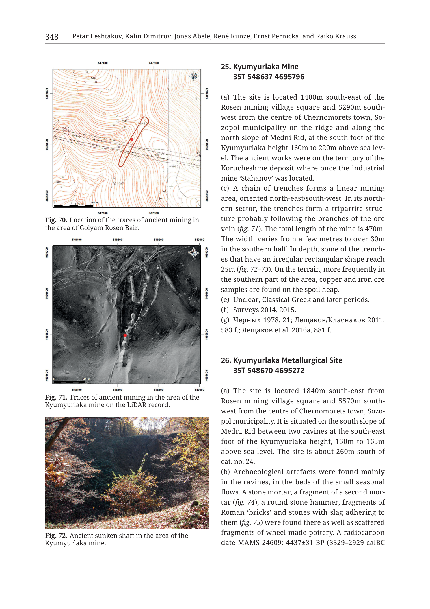
mixed
p. 348 (printed header); entries 25. Kyumyurlaka Mine and start of 26. Kyumyurlaka Metallurgical Site; Figs. 70–72
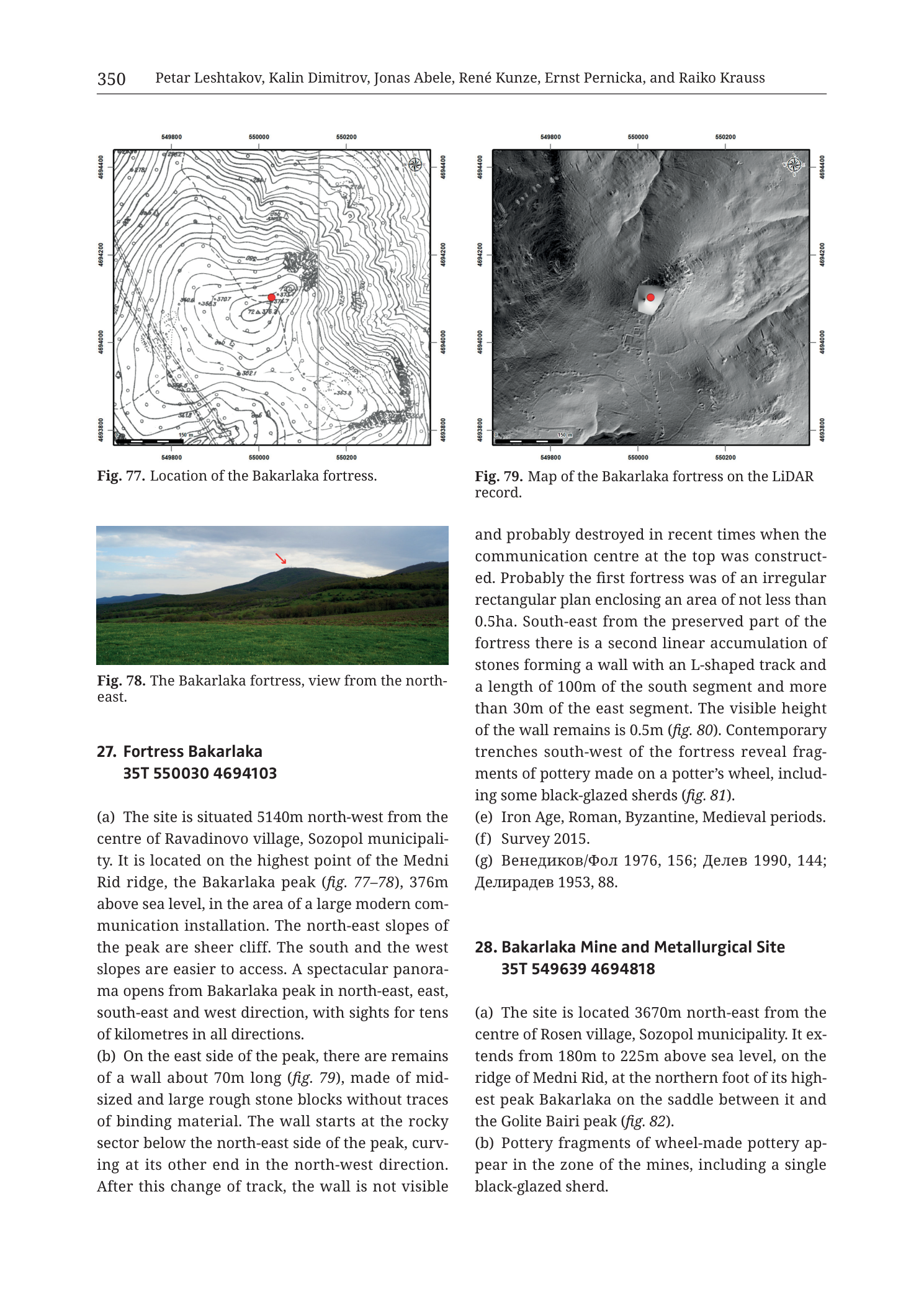
mixed
p. 350 (printed header); entries 27. Fortress Bakarlaka and start of 28. Bakarlaka Mine and Metallurgical Site; Figs. 77–79
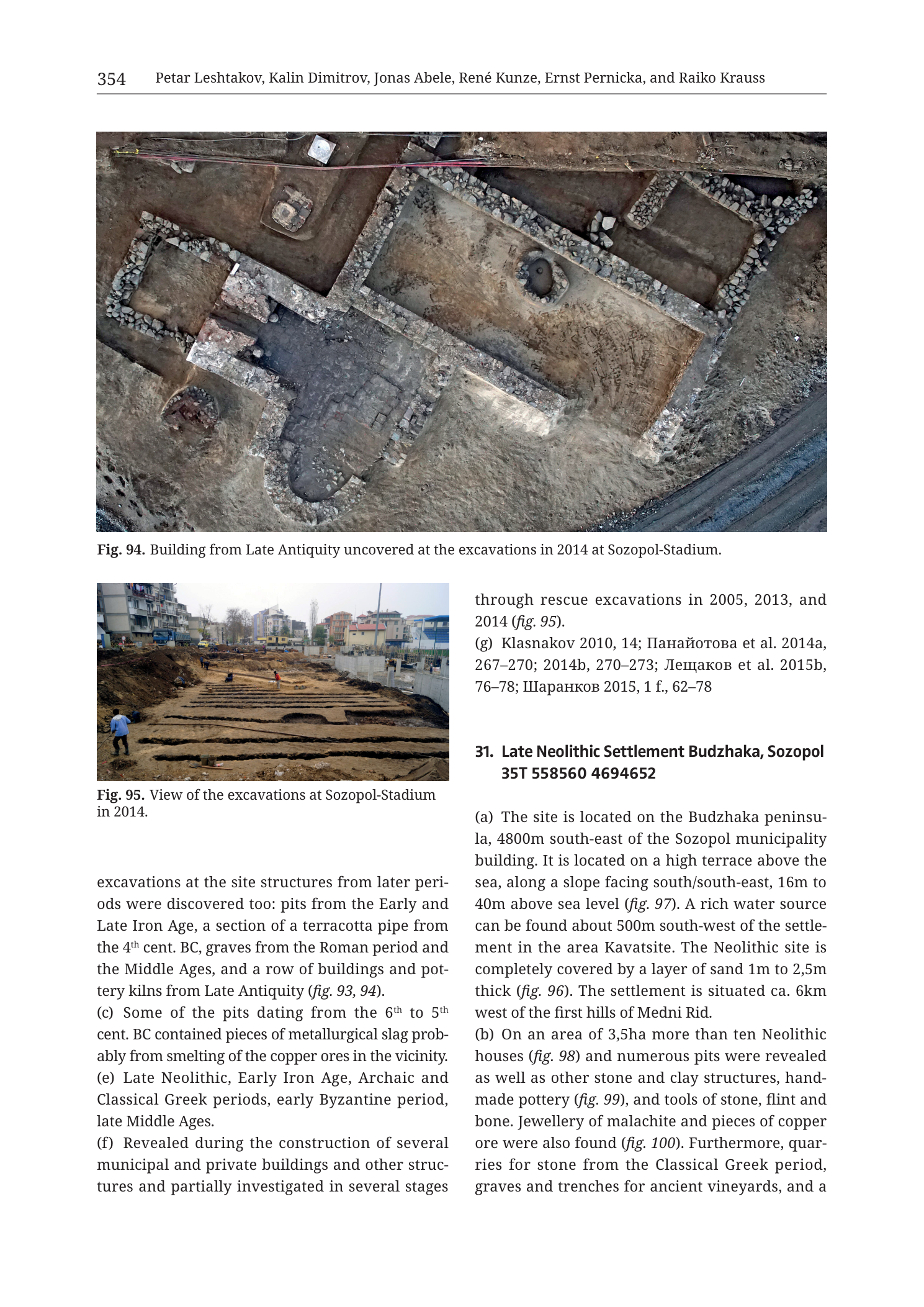
mixed
p. 354 (printed header); close of prior Sozopol-Stadium entry; start of 31. Late Neolithic Settlement Budzhaka, Sozopol; Figs. 94–95
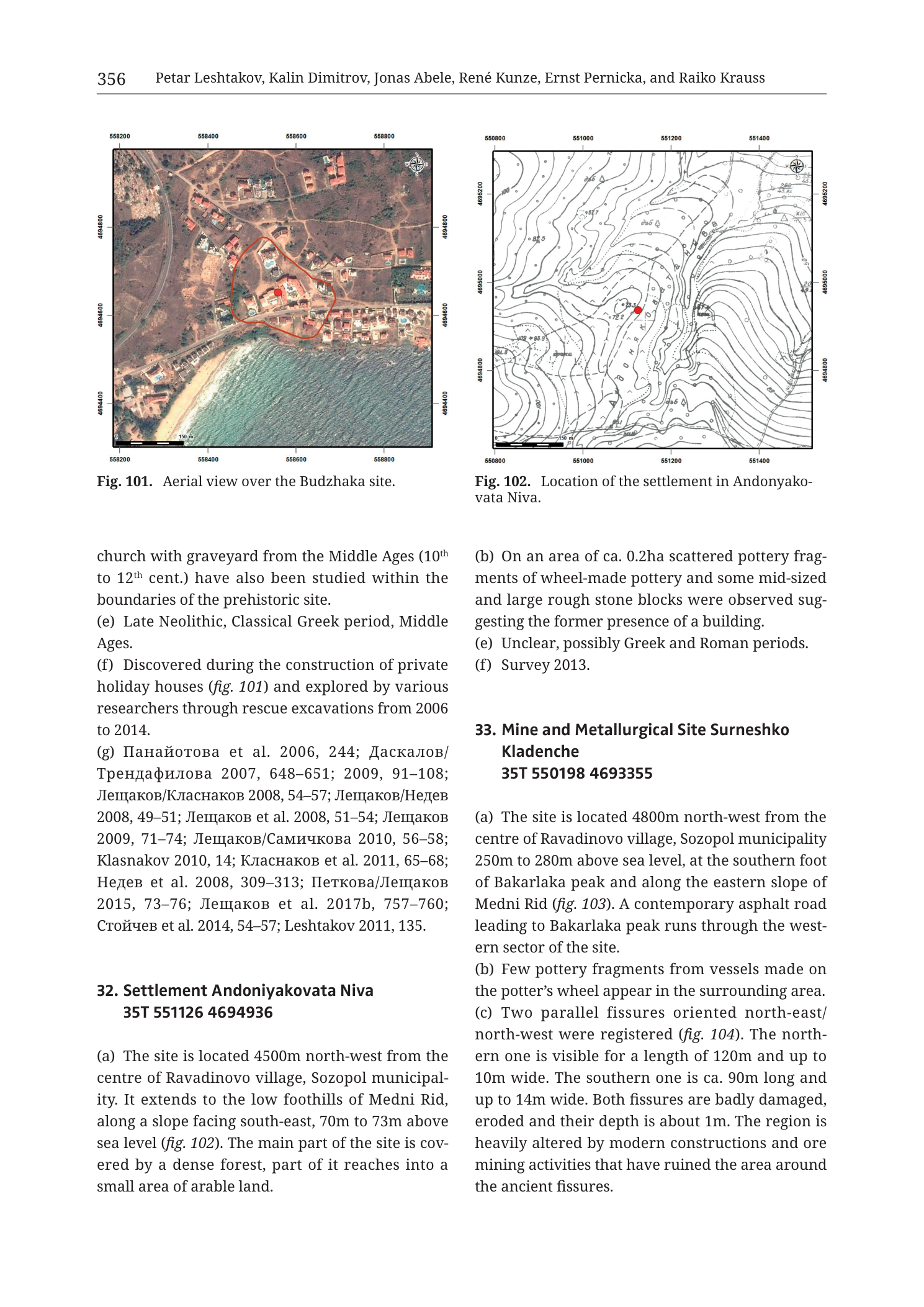
mixed
p. 356 (printed header); catalogue entries 32–33; Figs. 101–102
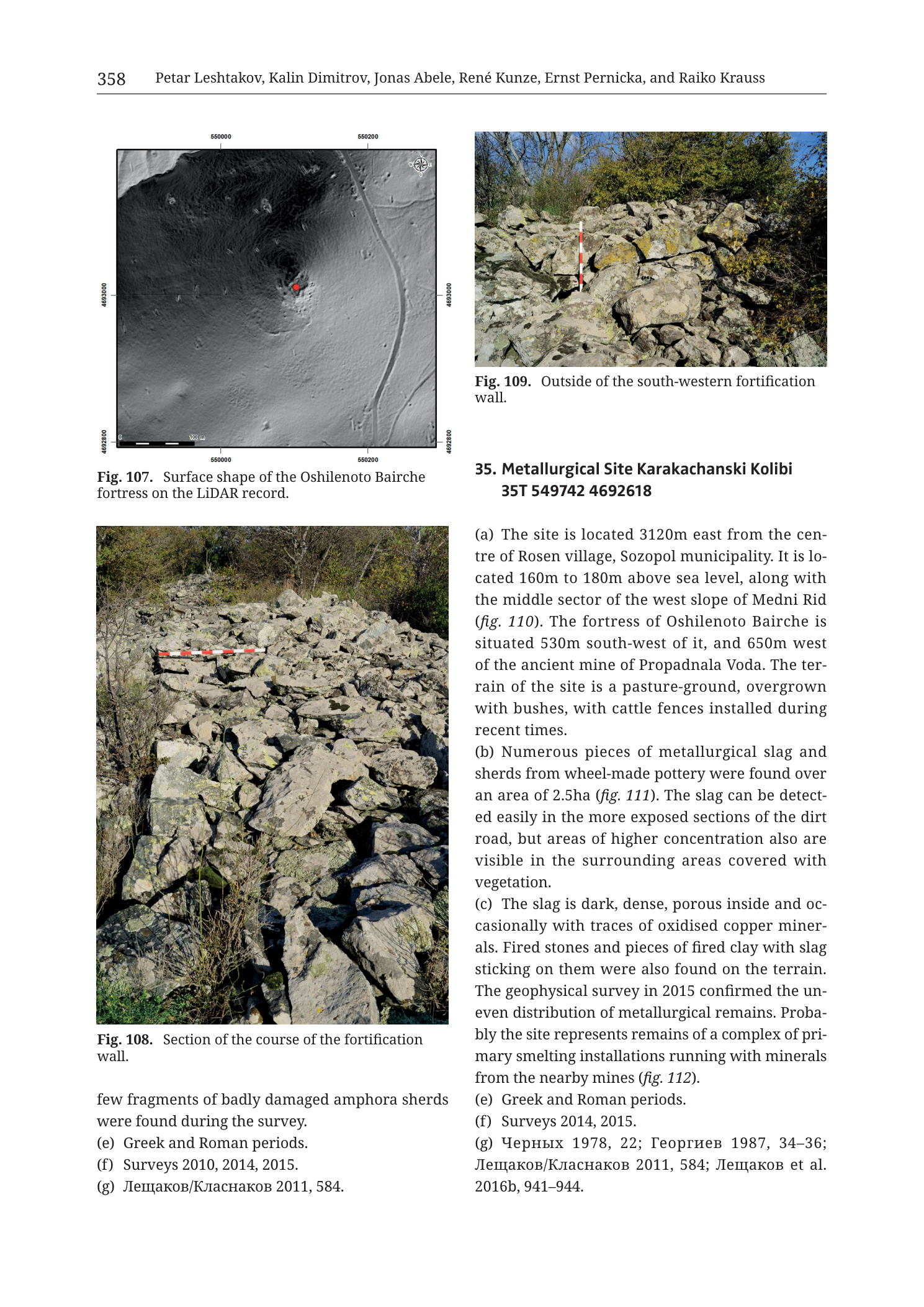
mixed
p. 358 (printed header); catalogue entry 35; Figs. 107–109
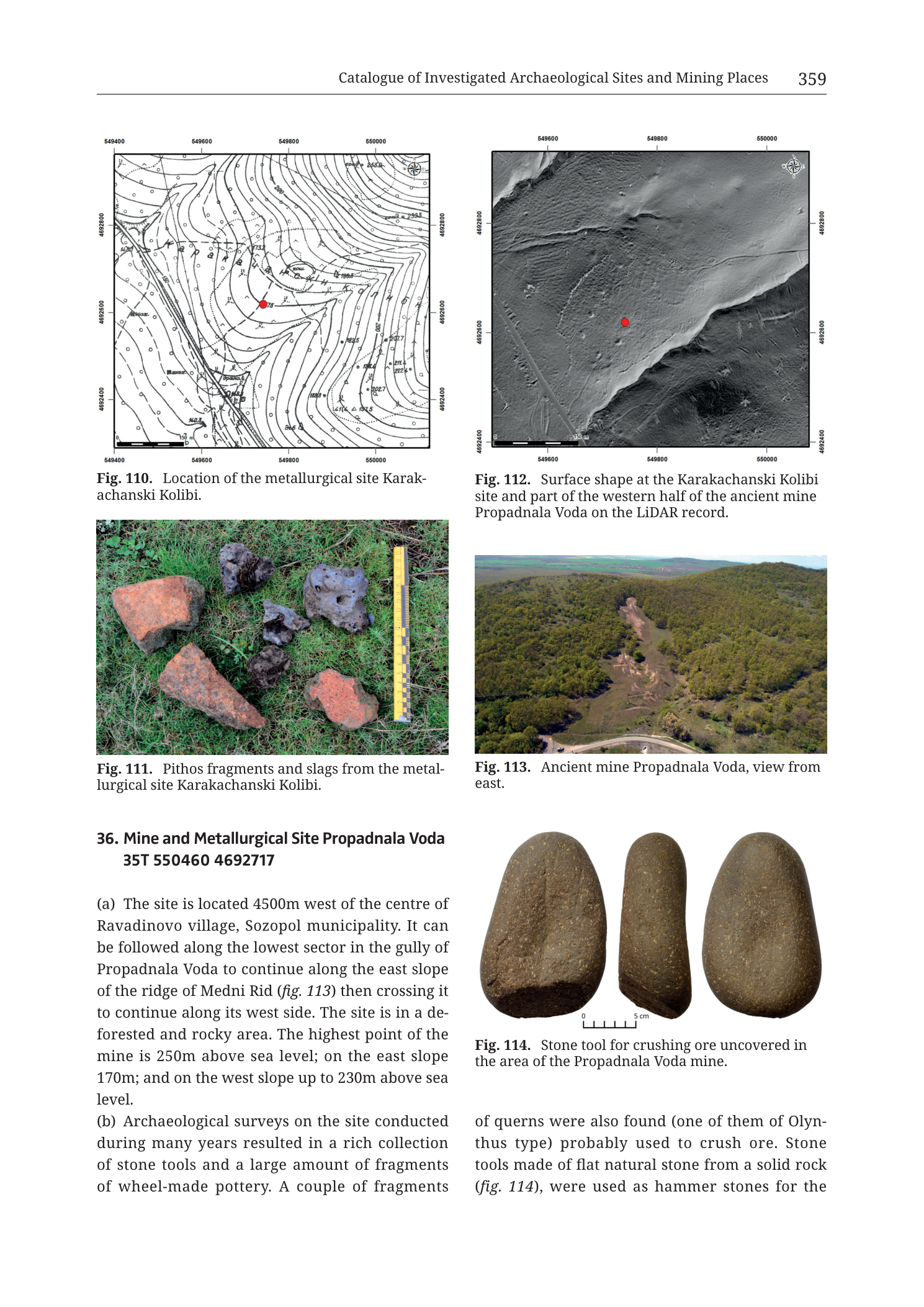
mixed
p. 359 (printed header); catalogue entry 36; Figs. 110–114
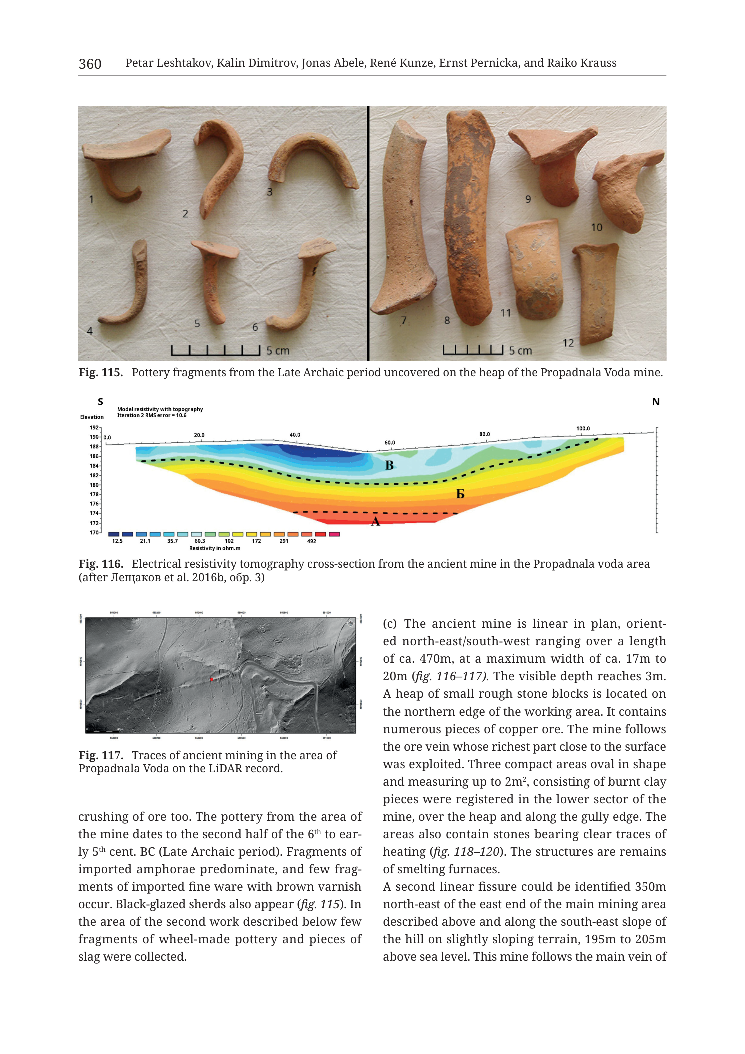
mixed
p. 360 (printed header); catalogue entry 36 continued; Figs. 115–117
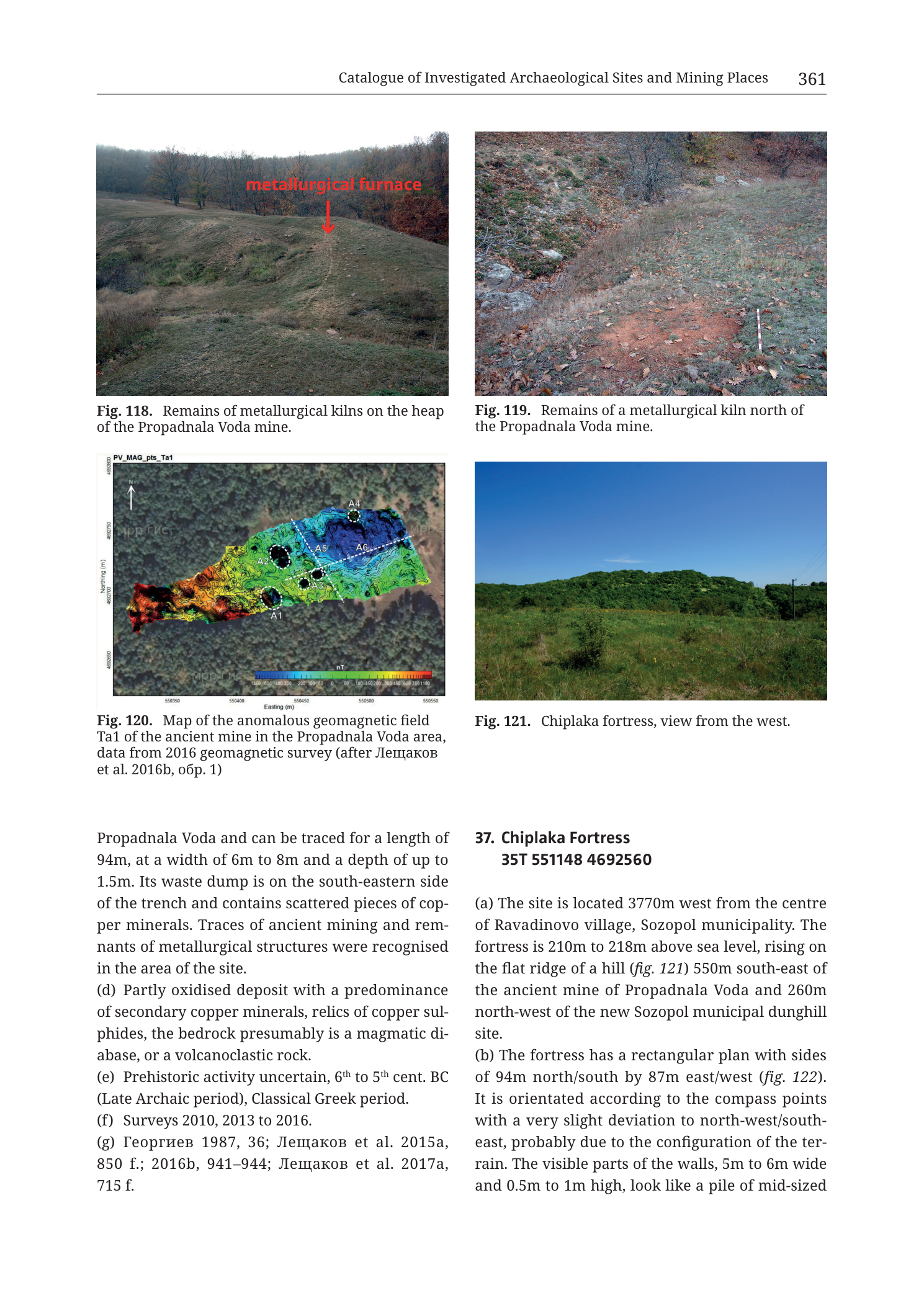
mixed
p. 361 (printed header); catalogue entries 36 (end) and 37 (start); Figs. 118–121
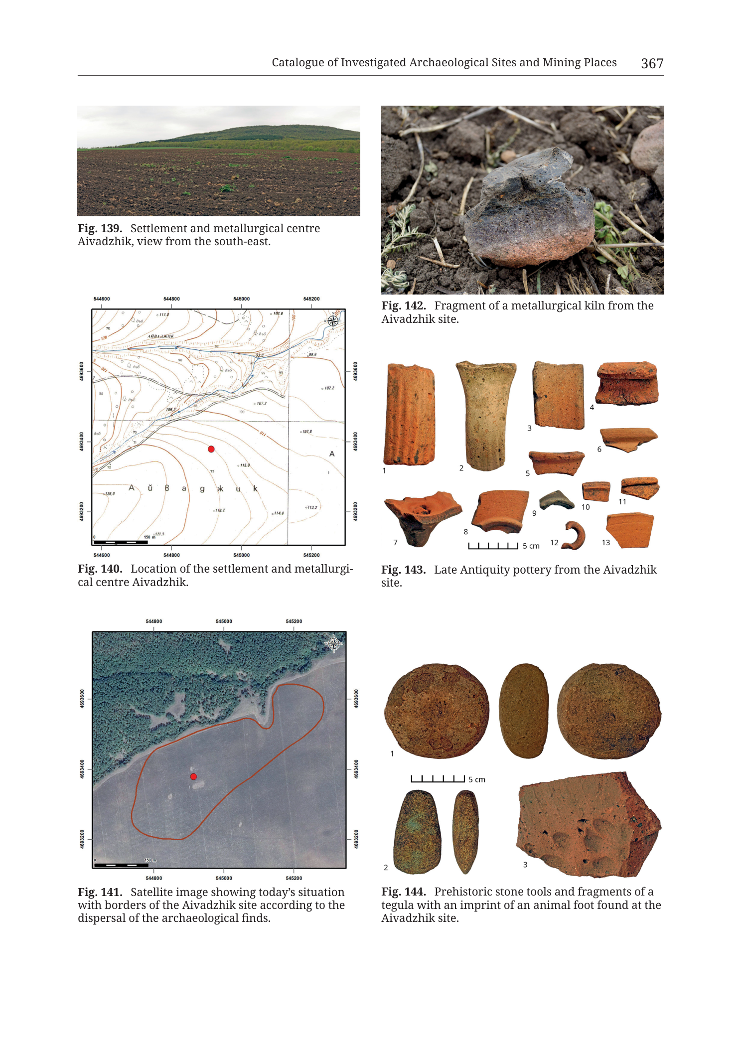
mixed
p. 367 (printed header); Figs. 139–144; filename Cat_p369_n42
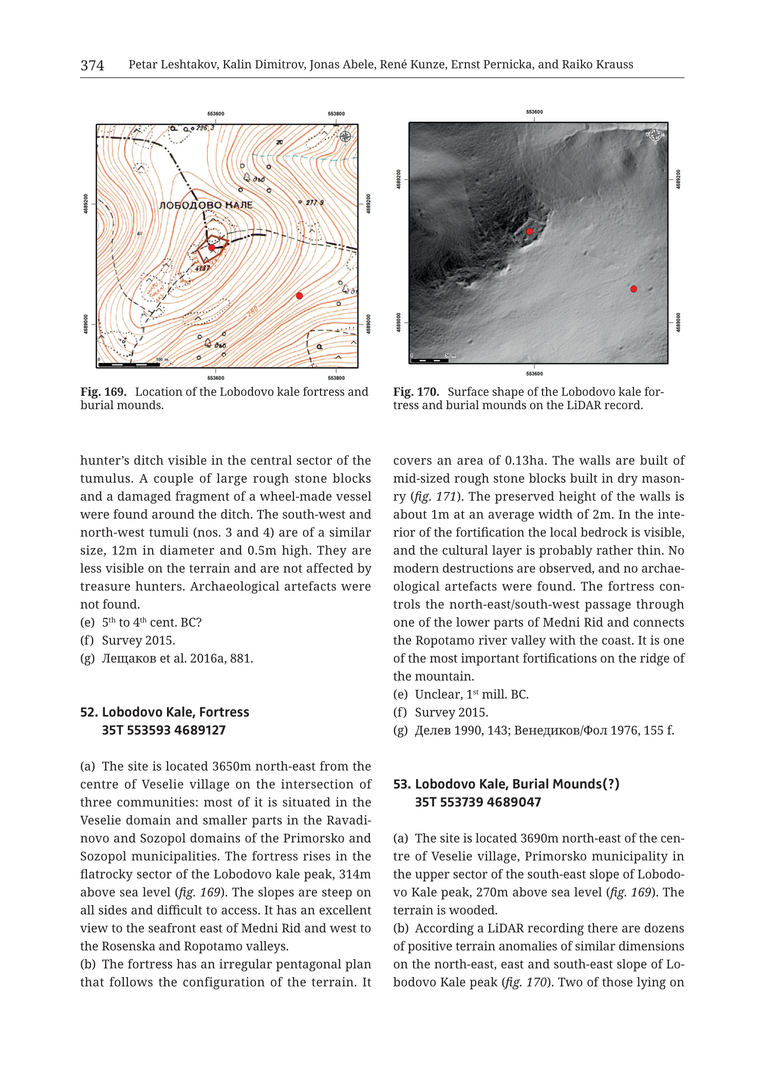
mixed
p. 374 (printed header); Figs. 169–170; catalogue entries 52–53; filename Cat_p376_n52
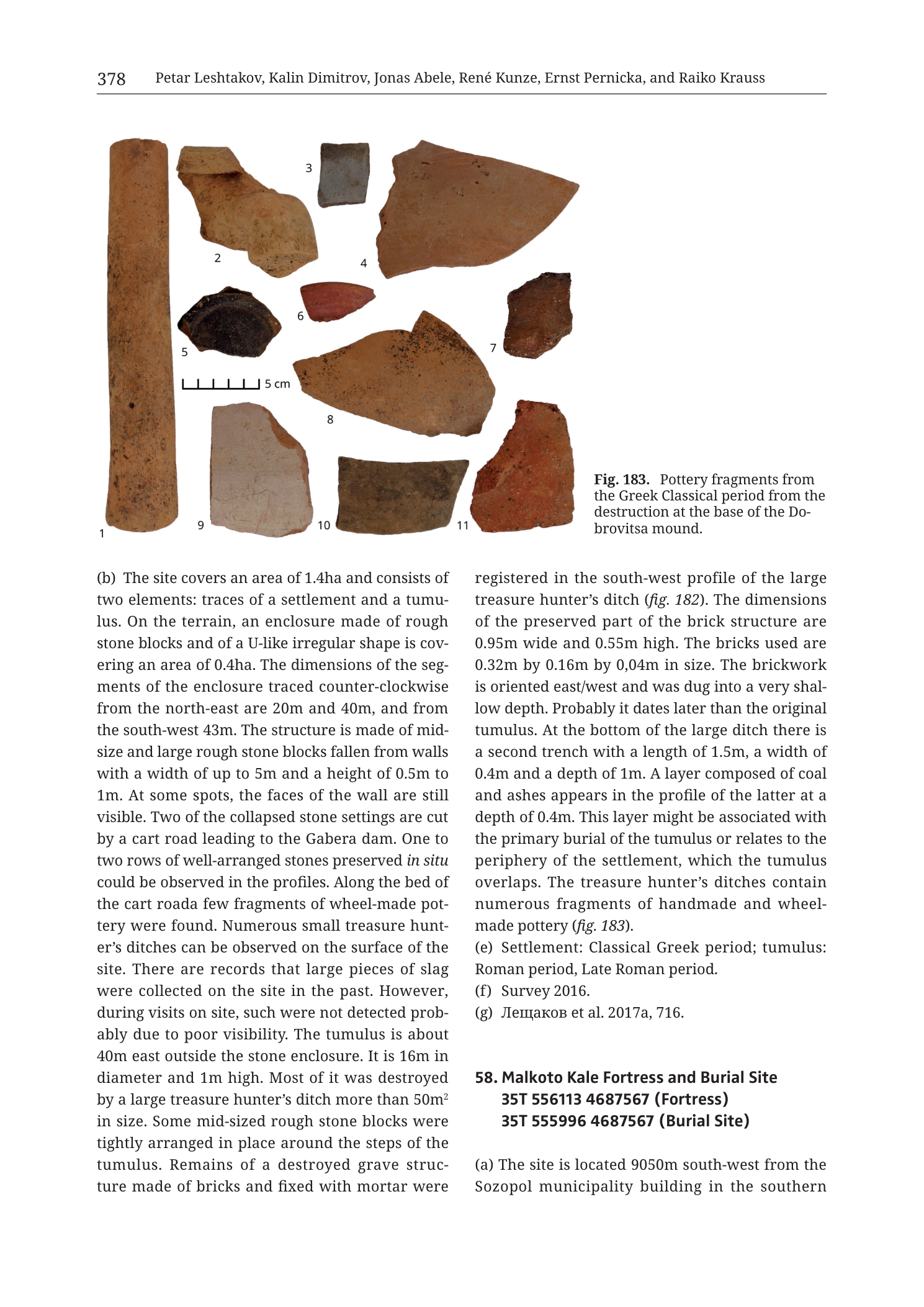
mixed
p. 378 (printed header); Fig. 183; start of catalogue entry 58; filename Cat_p380_n58
photograph
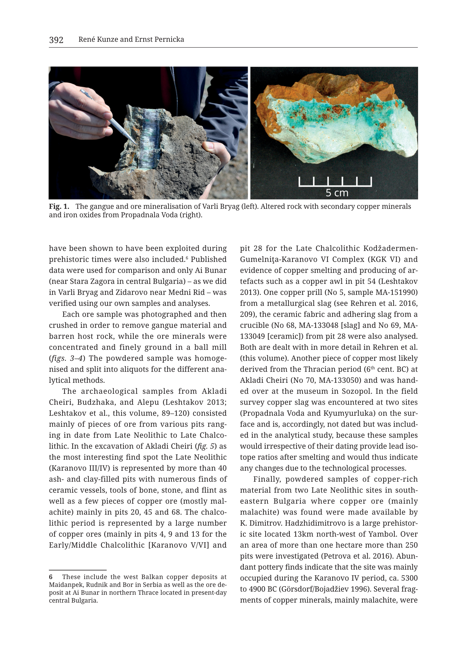
p. 392 / Fig. 1 (filename Tub_p394)