Description
Transcription
Page header
- Header (centred top): “Catalogue of Investigated Archaeological Sites and Mining Places”
- Page number (top-right): 341
Fig. 46 — Photograph (upper-right)
Caption: “Fig. 46. Tumulus-like height at the western part of the Bakar Bokluk site.”
No text on the photograph itself.
Fig. 47 — Photograph (middle-right)
Caption: “Fig. 47. Kaleto Krushevets fortress, view from the south-east.”
No text on the photograph itself.
Fig. 48 — Photograph (lower-right, above continuing text)
Caption: “Fig. 48. Course of the fortification wall.”
No text on the photograph itself.
Left-column body text — continuation of entry 16 (Fortress Krushevets Kaleto; heading on previous page)
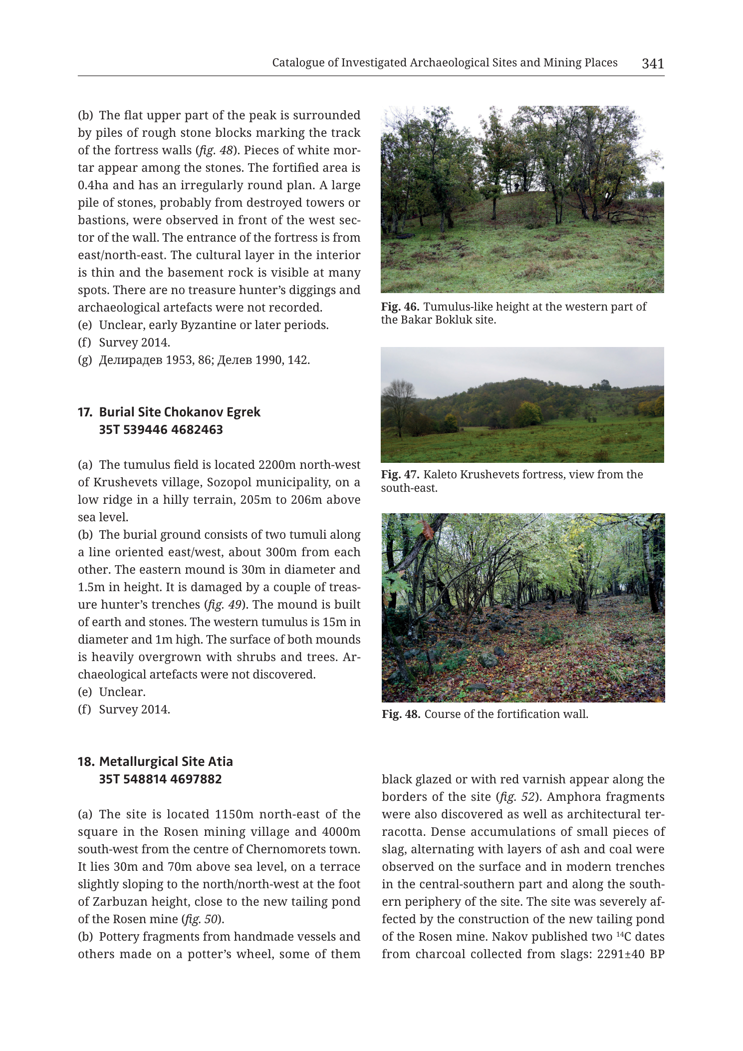
“(b) The flat upper part of the peak is surrounded by piles of rough stone blocks marking the track of the fortress walls (fig. 48). Pieces of white mortar appear among the stones. The fortified area is 0.4ha and has an irregularly round plan. A large pile of stones, probably from destroyed towers or bastions, were observed in front of the west sector of the wall. The entrance of the fortress is from east/north-east. The cultural layer in the interior is thin and the basement rock is visible at many spots. There are no treasure hunter’s diggings and archaeological artefacts were not recorded.”
“(e) Unclear, early Byzantine or later periods.”
“(f) Survey 2014.”
“(g) Делирадев 1953, 86; Делев 1990, 142.”
- Translation (bibliographic surnames): Deliradev 1953, 86; Delev 1990, 142.
Entry 17 — full text on this page
Heading: “17. Burial Site Chokanov Egrek 35T 539446 4682463”
“(a) The tumulus field is located 2200m north-west of Krushevets village, Sozopol municipality, on a low ridge in a hilly terrain, 205m to 206m above sea level.”
“(b) The burial ground consists of two tumuli along a line oriented east/west, about 300m from each other. The eastern mound is 30m in diameter and 1.5m in height. It is damaged by a couple of treasure hunter’s trenches (fig. 49). The mound is built of earth and stones. The western tumulus is 15m in diameter and 1m high. The surface of both mounds is heavily overgrown with shrubs and trees. Archaeological artefacts were not discovered.”
“(e) Unclear.”
“(f) Survey 2014.”
(Note: field (c), (d), and (g) are not printed for entry 17 on this page.)
Entry 18 — Metallurgical Site Atia (starts left column, continues right column under Fig. 48)
Heading: “18. Metallurgical Site Atia 35T 548814 4697882”
“(a) The site is located 1150m north-east of the square in the Rosen mining village and 4000m south-west from the centre of Chernomorets town. It lies 30m and 70m above sea level, on a terrace slightly sloping to the north/north-west at the foot of Zarbuzan height, close to the new tailing pond of the Rosen mine (fig. 50).”
“(b) Pottery fragments from handmade vessels and others made on a potter’s wheel, some of them”
(text continues in right column beneath Fig. 48:)
“black glazed or with red varnish appear along the borders of the site (fig. 52). Amphora fragments were also discovered as well as architectural terracotta. Dense accumulations of small pieces of slag, alternating with layers of ash and coal were observed on the surface and in modern trenches in the central-southern part and along the southern periphery of the site. The site was severely affected by the construction of the new tailing pond of the Rosen mine. Nakov published two ¹⁴C dates from charcoal collected from slags: 2291±40 BP”
(text ends mid-sentence at page break; remainder of entry 18 continues on the next page, not in this PNG.)
Description
TYPE & PURPOSE
Multi-panel catalogue page from Krauss et al. (2020) presenting:
- the closing fields of 16. Fortress Krushevets Kaleto (morphology, dating, survey, bibliography);
- the complete short entry 17. Burial Site Chokanov Egrek;
- the greater part of 18. Metallurgical Site Atia (location, finds, slag/ash stratigraphy, damage by Rosen mine tailings, start of ¹⁴C results);
- three landscape/site photographs (Figs. 46–48) that illustrate Bakar Bokluk’s western mound (from the previous entry sequence), the Kaleto fortress hill, and the Kaleto fortification-wall course.
No coordinate-gridded map, geological map, or artefact studio plate appears on this page. Purpose for the filename target (n18 Atia): locate and characterise a slag-and-ash metallurgical site on a low terrace between Rosen mining village and Chernomorets, at the foot of Zarbuzan height beside the modern Rosen tailings pond — i.e. directly in the Rosen ore-field coastal fringe.
OVERALL PAGE LAYOUT
- Portrait two-column catalogue layout.
- Left column: end of entry 16 (b, e, f, g); full entry 17; start of entry 18 (heading, centroid, (a), start of (b)).
- Right column: Fig. 46 + caption; Fig. 47 + caption; Fig. 48 + caption; continuation of entry 18 (b) through the first ¹⁴C date.
- Running header: catalogue chapter title; printed page 341.
Fig. 46 — TUMULUS-LIKE HEIGHT, BAKAR BOKLUK
- Colour landscape photograph under overcast light.
- A low, rounded grassy mound (tumulus-like elevation) occupies the mid-ground, crowned and flanked by several deciduous trees (some with sparse/autumn foliage).
- Foreground: short green grass / pasture.
- Background: pale overcast sky; further trees behind the mound.
- No people, scale objects, or overprinted labels.
- Illustrates the 4–5 m high vegetation-covered tumulus-like rise at the western end of Bakar Bokluk described in entry 15 on the previous page (and cross-referenced there as fig. 46). Belongs to Bakar Bokluk, not to Atia.
Fig. 47 — KALETO KRUSHEVETS FORTRESS, VIEW FROM SE
- Colour landscape photograph, view from the south-east (per caption).
- A wooded hill fills the mid-to-background: continuous tree canopy (mixed green and autumn tones) rising from a grassy foreground meadow/field.
- Overcast grey sky.
- No buildings, walls, or people clearly resolved at this distance — the fortress is expressed as the hill mass itself.
- Matches entry 16’s setting: low elevation with steep slopes along the Izvorska River right bank.
Fig. 48 — COURSE OF THE FORTIFICATION WALL
- Colour photograph taken under tree canopy along a linear forest-floor feature.
- A subtle raised alignment of earth and stones (the fortification wall course) runs away from the viewer through leaf litter, flanked by trunks and understorey shrubs.
- Lighting is diffuse forest shade; autumn leaf cover on the ground.
- Directly illustrates entry 16 (b): piles of rough stone blocks marking the track of the fortress walls; thin interior cultural layer; basement rock locally visible (rock/stone rubble apparent along the alignment).
- Cross-referenced from entry 16 (b) as fig. 48.
ENTRY 16 CONTINUATION — FORTRESS KRUSHEVETS KALETO
Building on the location paragraph from the previous page:
- (b) Morphology / condition: flat upper peak surrounded by piles of rough stone blocks = wall track; white mortar pieces among stones; fortified area 0.4 ha, irregularly round plan; large stone pile (probable destroyed towers/bastions) in front of west wall sector; entrance from east/north-east; thin interior cultural layer with basement rock often visible; no treasure-hunter diggings; no archaeological artefacts recorded.
- (e) Dating: Unclear, early Byzantine or later periods.
- (f) Fieldwork: Survey 2014.
- (g) Bibliography: Делирадев 1953, 86; Делев 1990, 142.
Figs. 47–48 are the visual record for this fortress entry.
ENTRY 17 — BURIAL SITE CHOKANOV EGREK (COMPLETE ON PAGE)
- Centroid: 35T 539446 4682463
- (a) Location: 2200 m NW of Krushevets village, Sozopol municipality; low ridge in hilly terrain; 205–206 m a.s.l.
- (b) Description: two tumuli on an E–W line, ~300 m apart;
- eastern mound: 30 m diameter, 1.5 m high; damaged by treasure-hunter trenches (fig. 49 — not on this page); built of earth and stones;
- western mound: 15 m diameter, 1 m high;
- both heavily overgrown with shrubs and trees; no archaeological artefacts discovered.
- (e) Dating: Unclear.
- (f) Fieldwork: Survey 2014.
- Fields (c), (d), (g) not printed on this page for this entry.
- No photograph of Chokanov Egrek on this page (fig. 49 cited but absent).
ENTRY 18 — METALLURGICAL SITE ATIA (PARTIAL; PRIMARY FILENAME TARGET)
- Centroid: 35T 548814 4697882
- (a) Location / setting:
- 1150 m NE of the square in Rosen mining village;
- 4000 m SW of the centre of Chernomorets town;
- elevation between 30 m and 70 m a.s.l.;
- on a terrace slightly sloping N/NW at the foot of Zarbuzan height;
- close to the new tailing pond of the Rosen mine (fig. 50 — not on this page).
- (b) Finds and metallurgical residues (as far as printed on this page):
- pottery from handmade vessels and wheel-made vessels, some black-glazed or with red varnish, along site borders (fig. 52 — not on this page);
- amphora fragments;
- architectural terracotta;
- dense accumulations of small slag pieces alternating with layers of ash and coal, on the surface and in modern trenches, in the central-southern part and along the southern periphery;
- site severely affected by construction of the new Rosen mine tailing pond;
- Nakov published two ¹⁴C dates from charcoal collected from slags; first value given: 2291±40 BP (second date and remaining fields cut off at page end).
SPATIAL RELATIONSHIPS (PAGE-LEVEL)
- Atia metallurgical site sits in the immediate Rosen ore-field coastal lowland: between Rosen village and Chernomorets, on a low terrace (30–70 m) at Zarbuzan’s foot, abutting modern Rosen mine tailings infrastructure. This places ancient/historical metallurgical waste directly next to one of the named Rosen-field mining centres treated elsewhere in the volume and in Tzankova (2023).
- UTM 548814 E / 4697882 N is east and somewhat south of the higher Medni Rid mine centroids around Varli Bryag (~532000 E / 4700400 N) and west of the outermost coastal strip — consistent with the Rosen–Chernomorets corridor.
- Krushevets Kaleto and Chokanov Egrek remain in the Krushevets / Izvorska cluster (~538700–539500 E / ~4681500–4682500 N), several kilometres south of the Atia/Rosen coastal sites — same catalogue chapter, different micro-region.
- Bakar Bokluk’s western mound (Fig. 46) is still in the Krushevets cluster; its figure landed on this page by layout flow after entry 15.
- Atia’s slag + ash/coal layering and ¹⁴C charcoal-from-slag programme mark it as a dated smelting/processing locality, not merely a pottery scatter; modern tailings construction is an explicit taphonomic/destruction factor.
RELATIONSHIP TO OTHER FIGURES
- Entry 16 (b) → fig. 48 (on this page); location context also uses fig. 47 (on this page).
- Entry 15 (previous pages) → fig. 46 (printed here).
- Entry 17 (b) → fig. 49 (not on this page).
- Entry 18 (a) → fig. 50 (not on this page); (b) → fig. 52 (not on this page).
- Filename targets n18 Atia; accompanying photos on the plate are mostly for Bakar Bokluk and Kaleto because of catalogue pagination.
Consistency Check
- No coordinate-gridded map on this page → map-axis bracket check does not apply.
- Printed centroids (plausibility only, SE Bulgaria UTM 35T):
- Chokanov Egrek: 35T 539446 4682463 — E and N within expected regional ranges.
- Atia: 35T 548814 4697882 — E and N within expected regional ranges; easting ~548814 is toward the more easterly coastal sector near Chernomorets/Rosen, matching the prose location.
- Result: N/A (no map axes).
Notes
- Filename
Cat_p343_n18_Atia_metallurgical_site.pngvs printed page 341: book/PDF page offset as elsewhere in this collection; printed header page is authoritative. - Entry 18 is truncated mid-sentence after the first ¹⁴C date (2291±40 BP); the second Nakov date, remaining lettered fields (c–g), and any further figures are not on this image.
- Fig. 46 belongs to Bakar Bokluk (entry 15), not Atia — do not attach it to the Atia site description analytically beyond shared chapter context.
- Entry 17 lacks (c)(d)(g) as printed — not a transcription gap of visible text.
- Superscript ¹⁴C rendered as printed scientific notation in the book; BP age copied exactly: 2291±40 BP.
- “30m and 70m above sea level” transcribed as printed (range phrasing in the original).
- None further.